The Hula Horn

One of the biggest factors in Leaving Haines after 8 consecutive winters living there and moving back to Alaska’s vast interior was simply a matter having access to both the Alaska Range and the Brooks Range. Fairbanks is a great focal point for both, especially for the central and eastern parts of the Alaska Range, and equally so to the monumental Brooks Range, one biggest and most remote mountain regions on the planet; a place to fill a dozen lifetimes worth of exploring.

For me, summer 2023 was getting off to a late start. At least that’s how it felt. What was originally proposed as a start to our work projects at Takahula Lake in mid-late June, began in earnest here in Fairbanks the first week of July. I spent that time cutting trees and clearing a site for a future cabin build here on my property in the Goldstream Valley to the north of Fairbanks. Eventually, my workmate Richard Baranow arrives in town, and along with our other workmate Jared Brantner, we embark on several days of material purchasing and logistics for three people, two dogs, and over 12,000 pounds of food, tools, building materials, and supplies for 8 weeks worth of construction projects. Our project site is a cabin situated on the shores of Takahula Lake, located within the Gates of the Arctic National Park and adjacent to both the Alatna River and the Arrigetch Peaks region.

Bettles, Alaska, located over 200 miles north of Fairbanks, is a tiny village situated along the prominent and historic Koyukuk River and home to less than thirty people. Angela has been living there recently for her new job at the Bettles weather watch station, but with all the chores at hand unloading airplanes and organizing, we barely have time to see one another. The launching point for a most trips into this part of the Brooks Range generally begin here, with an airstrip that can receive both small and large aircraft; and from which smaller bush planes can take one deeper into the heart of the Brooks. From Fairbanks, we charter a Cessna Caravan via Wright Air Service to get the three of us, the two dogs Taka and Hula, all of our personal tools and gear, and a weeks worth of food to Bettles. For the remainder of our nearly 10,000 pounds of lumber, food, and building materials, a Curtiss C-46 Commando is employed and scheduled to arrive in Bettles that very same day. Once in Bettles, the task of unloading and organizing everything was at hand so it could all be flown the 60 plus miles to Takahula Lake with smaller 1000 pound loads via DeHavilland Beaver, an aircraft of legendary status in the world of remote Alaska bush flying. After a couple days of rain in Bettles, I say a quick goodbye to Angela, and we climb into the Beaver with dogs, food, and tools bound for Takahula Lake

Heading west and flying just south of the massive Brooks Range divide, we follow the Koyukuk River before crossing both the Wild and John Rivers, then sneaking past the Alatna Hills and up The Malamute Fork that eventually leads to the Iniakuk River and the Alatna River, one of the central Brooks Range’s primary water systems. We turn north, just past Iniakuk Lake, where we drop into and continue up the Alatna river until Takahula comes into view. Flying over the Brooks Range region in the summer is a special treat, with literally hundreds of rivers, creeks, and ponds visible among the endless valleys and countless summits both un- named and many un-climbed. It’s vastness is quite overwhelming and getting ones mind around it’s true size is somewhat mind boggling. Soon, the 1957 DeHavilland Beaver touches its floats down on the lake surface and we find ourselves taxiing towards the obvious cabin on the northeast corner of the Lake. The next several days are spent organizing load after load from Bettles, getting our camp up and running, and handling some preliminary work details to align the summer’s work projects.

Across the lake, a prominent, sharp limestone peak commands our attention every single day after work as we eat our supper on the cabin porch overlooking the lake. Richard names it the Hula Horn after his lovely pooch Hula, whose namesake is also born of the region. After a couple of weeks of hard labor and accomplishing a portion of our set goals, we decide that a break is in order, and we set our eyes on the Hula Horn, which according to Richard, is most likely unclimbed.

The following day at around noon, we load up the canoes and paddle to the southwest side of the lake, where there is a large beach and is a popular spot for folks coming down the Alatna River to be picked up. It is one of the very few camp spots on the lake, and is thus overused and worn. We stash our canoes here and begin hiking north along the shore of the lake, searching for a way around the obvious tussock swamp adjacent to it. Once found, we make our way through the low lying taiga and aim for a high rocky point on the ridge, where once gained, a short thrash down a gully system leads us to the edge of the beautiful Takahula River. Regretting not bring a pair of running shoes or sandals for river crossings, I roll up pant legs and cross the knee deep torrent of ice cold mountain water barefoot. Richard has brought a lightweight pair of hip waders and crosses with the two dogs in tow with ease. Jared manages the crossing in his socks, and soon we are hiking up the sparse boreal forest towards another high point where just below, another river crossing awaits. This river, an un-named creek at the foot of the Hula Horn itself, we name Freya Creek, after Taka and Hula’s mother. Freya Creek is much narrower than the Takahula River, but it is deep, fast, and icy. In fact, it is narrow enough to allow Richard to go first with his deluxe hip waders, then once across, he rolls them up and tosses them to each Jared and I to use. Soon we are aiming for lightly vegetated areas comprised of mostly lichen and moss; interestingly, these areas tend to be dry and very easy to travel upon. Eventually, the going gets steep and we are skirting a great limestone cliff of perhaps 150 feet in height; at it’s top, the terrain is steeper yet, where it becomes what one might call class III or IV moss. At the top of the steepest section, we now find ourselves at tree line just below the North Ridge leading up the Hula Horn. A short scramble past a lone Spruce tree puts us on the firm tundra and lichen covered ridge, where we rest for a spell and take in the outstanding views of Takahula Lake, Takahula Peak, the Alatna River, and the several dozen un-named peaks surrounding the area.

From the ridge, the walking is incredibly casual where one meanders open tundra, Caribou trails, and skirting small limestone outcroppings to one side or the other. After a good long section of these pleasantries, the route becomes, steep, loose, and muddy. Jared being many years younger than both Richard and I is far, far ahead of us, and I catch a glimpse of him and the dogs on a shelf about a half mile off and many hundreds of feet higher. Richard and I are running low on water, but a seeping spring oozing from a mud entrenched limestone shelf provides relief to our searing throats and near empty water bottles. Ahead, the route continues its steepness; yet treacherous sections force us to begin skirting and scrambling to the west side of the ridge, where after a multitude of nuanced zig zags deposits us below a cliff band below the summit block. Jared is seen up near the summit, and the dogs are left below, where Richard ties them up out of harms way. Up a short limestone crack system with a couple of moves of class IV rock climbing and we are standing on the narrow rocky summit. The view from the top is mesmerizing; the long and jagged line of granite of the fabled Arrigetch Peaks stretches out before us, and way, way off to the west, the thin outline of Mt Igikpak (8510′), one of the highest peaks in the Brooks can be just barely seen. Igikpak lies in a remote region near the headwaters of the wild Noatak River, and was first climbed in 1968 by David Roberts, Chuck Loucks, and Al De Maria. Since then it has only seen a handful of ascents. To the south, endless valleys, rivers, and un-named peaks stretch for as far as the eye can see, leading to more unseen rivers and drainages feeding the Yukon River region of central Alaska. To the north and east massive peaks dot the horizon before the landscape gives way to the arctic plain commonly referred to as the North Slope. We build a cairn, sign our newly made summit register, and begin the long descent down the zig zagging traverses and rocky scrambles that lead to easier walking along the tundra covered ridge. Once back in the forest, the mosquitos come out in hordes and we make haste back to the canoes, where a paddle across the lake at almost 2 am in the Alaska twilight has me nearly passing out from exhaustion. 14 hours after starting the Hula Horn, we are back at the cabin sipping beer and eyeballing the peak we had just climbed.

The next day is spent doing absolutely nothing, but over the following days and weeks, we put a good dent in our primary work goal for the summer: a 16′ X 25′ wooden framed deck with a steel framed vinyl storage tent erected on its top, which is to serve as storage for the entire cabin site and 5 acre property, holding everything from tools and building materials, to hiking and backcountry gear, to hunting and fishing equipment, to fuel, propane, paints, goods, and supplies of most anything imaginable that one may need at a remote Brooks Range outpost.

A couple of days before we are scheduled to be picked up and flown out, I decide to head up the Takahula River solo to inspect and potentially packraft it. So late one morning I pack up my backcountry kit, inflate my raft, and paddle across the lake where I’m able to easily hike over the ridge to the Takahula drainage below. At river’s edge, a crossing is unrealistic and an epic bushwhack ensues up river, where I’m forced up a hillside to avoid the worst of it. Eventually the thrashing subsides slightly as I’m gaining altitude and the forest is thinning. A great set of rocky and turbulent rapids steers me up to a rocky vantage and some spectacular views of the previously unseen mountains to the northwest near the Takahula headwaters come into sight. Looking back downstream, I now see the Hula Horn; this time from an impressive alternate perspective. It’s elegant and complex lateral ledges and zig zags ever so visible. I descend the rocky point into an open stone filled valley situated at the foot of Takahula Peak near it’s west- north-west shoulder. The sun comes out and walking the rocky tundra is a pleasure; I half expect to spot a Bear, Moose, or Caribou traveling its confines, but never do. Up ahead, the roar of another hefty rapid entices me to inspect, where I find an undercut bank preceded by voluminous drops and tight maneuvering. I feel fearful of paddling these features as it has been two full years since I have done any paddling at all, and now being here alone on an extremely remote river that has likely never been packrafted before, I am reticent as I eyeball these rapids and passageways.

I’m getting tired from the bushwhacking and meandering, and when an exceptional camp spot is stumbled upon, I decide to pitch my tent and call it a day. After supper, I walk downstream slightly to inspect a potential put-in for paddling tomorrow should I accept the challenge. The little spot is ideal as it has a nice even sandy approach into the river channel with low initial consequences. I navigate back to my camp, where a night of bad dreams about dangerous rapids interrupt any chance for good rest. Early in the wee hours, a steady rain begins to fall, and feeling unrested and uneasy, I mentally cancel any possibility of paddling the beautiful Takahula River on this trip. Later, and in a steady rain, I pack up my sopping wet camp and begin the long thrash back up to the ridge above Takahula Lake, and back down to a mellow paddle to the cabin.

A few days later I’m back in Fairbanks installing gravel over the cabin site I had prepared back in June, getting myself rested, and preparing for my friend Chris Gavin’s arrival for he and I to head down to the Alaska Range for a week or two of late season packrafting before winter unveils its grinning face.

Wild Wild River

A text from Sven asking me if I want to fly to Bettles for an overnight visit with Angela sees me prepping for a quick trip and buying a handful of groceries for Angela and I before meeting Sven at the East Ramp of the airport, and after fueling the 1969 Citabria, we are airborne and within a short time, crossing the massive Yukon River enroute to Bettles. After a bit, the monumental Brooks Range becomes visible stretching from one extreme horizon to the other, showcasing but a fraction of this massive range of peaks, rivers, lakes, and valleys. With a seemingly endless supply of these things and stretching from the British Mountains in Northwest Territories Canada all the way to the Bering Sea, the Brooks is one of the biggest and wildest mountain regions on the planet. Ever since reading about the Brooks Range in an old National Geographic at age ten or so, the Brooks has since been etched into my mind as the last true bastion of Alaskan wilderness and without a doubt, the scenery it exhibits is to my eyes the quintessential Alaska landscape.

After a night in Bettles, I accompany Angela to her job at the Bettles Weather Watch station at the airstrip. Sven stops in and after some conversation, he and I embark to handle some chores at his place, followed by jumping in his plane and flying into the Brooks Range ever so visible just north of town.

After crossing the Koyukuk River, we fly to the east of Mt Gilroy and into the Wild River Valley, where off in the distance we can see the southern tip of the incredible Wild Lake. We veer off to the right and into a valley containing Flat Creek, where we land on a remote privately owned airstrip where there are several remote cabins. We hop out of the plane and immediately see a long set of Grizzly tracks traversing the muddy gravel of the airstrip. After a short walk to inspect a cabin or two, we ‘re back the air, followed by a cruise back up the Wild River and across the still frozen Wild Lake. After spiraling upward to gain altitude, we cross over Seward Pass and descend into the Allen River region; Sven claiming it his favorite region in the southern Brooks Range, We fly down low along the river and over a canyon in which the river has cut deep walls and contains a twisting set of beckoning rapids; I cannot help myself to wonder if this magnificent river has ever been paddled.

Further down valley, we land on yet another remote and privately owned airstrip and set of cabins. This place is simply incredible, with a large airstrip, grassy meadows, sand several extremely nice, well stocked cabins – all right near the confluence of Crevice Creek and the Allen and John Rivers. Years back, this was a thriving remote guiding operation that had horses and a hay field and was considered the northernmost farm in North America. When the Gates of the Arctic National Park was established, the federal jurisdiction encroached upon the realm of the operation, and they slowly went out of business. Sven still uses this place as one of many stop overs on his multi-day guided dog mushing adventures with his company Arctic Winter Adventures.

After a lengthy look around, we are back in the air, crossing back over the Koyukuk, and into Bettles we land.

Delta Mountains Recon

A three day solo trip into the Delta’s (Eastern Alaska Range) to recon the approach to the north side of Icefall Peak. Turns out it would have been more like a 5 or 6 day trip to get all the way to the base of Icefall and back. It was more than I had planned, and being solo, there were features on the glacier below that disturbed me. Regardless, I was quite pleased to be out there on a good 18 mile ski round trip. The last night I was met with a severe winter storm including dumping snow and 60 mph gusts. It must have snowed close to a foot, but you wouldn’t know it due to the ferocious wind. I spent the entire night fully dressed with boots on and the pack packed minus tent and sleeping bag. The hours were spent bracing the single ski pole support and bracing the Hyperlight ‘Mid to prevent it from collapsing. It was a dicey situation to say the least. About 3 am the wind calmed quite a bit, and I bolted out into a whiteout, threw my shit in the pack, and skied out to the truck in severely limited visibility. After getting lost a couple times, I finally found myself skiing through Red Rock Canyon near Rainbow Mountain and followed a set of fresh Wolf tracks for over a mile before they dissappeared into what appeared to be a den. Another hour and I was at the truck overwhelmed with exhaustion.

Raven’s Roost

In Fairbanks this week, the thermometer marks the first time this winter where temperatures are dropping significantly below zero, with minus 28 Fahrenheit predicted for the coming nights. Last year at this time we had over two feet of snow on the ground and regular temps of minus 25-35 degrees. So far this year we have a mere 5 inches of snow and the low temp recorded at my place was minus 4 about two weeks ago. Every year is different it seems. Honestly, the amount of snow, mild temps, and ample sunshine has made this Fall and early Winter quite incredible. Perfect fat bike conditions really.

Next month also signifies the 10 year anniversary of Just Rolling By. Ten years…

2022 has been an odd year for me. It has had some major ups and downs and with not much to compare it to. Early in the year, I lost my father to illness, and after that, one “plan” after another simply toppled. Both work and play commitments ran the path of disintegration. I did not go on even one single big backcountry adventure, did not once strap crampons to boots, not once did I even unroll my pack raft, and I did not write a single article for Just Rolling By. Additionally, I took very few photographs in the process. An odd year indeed. Angela and I did manage a few day trips to different locations throughout the year however. Additionally, I did make a three day trip across the Denali Highway in June, but too much snow from a heavy winter limited my activity. I was fortunate also to have had the pleasure to go out flying with my buddy Sven on a few occasions to witness the glory of the Alaskan wilderness via its air-scape.

The big news of the year without a doubt was the purchase of a 2 acre parcel in an area of the western Goldstream Valley to the NW of Fairbanks that I now called home. After the initial purchase, I brought in over 1000 cubic yards of gravel tailings and created a nice level spot to park my Raven tiny home truck cabin, plus attached driveway. Raven’s Roost as I have dubbed it, is a beautiful and secluded spot surrounded by ski and fat bike trails out my doorstep and only a mere 8 miles from town. It has the solitude and quiet I need yet with accessibility at hand. I cut numerous trees and have plans to cut even more next summer for a cabin building site and additional sunlight. I needed both an outhouse and a storage shed so I built one in the same. When the Northstar Borough property tax assessor came by to appraise the property, he was impressed by the “nicest outhouse I’ve ever seen”, informing me that he thought at first it was simply a really nice storage shed till he saw the toilet seat. To my delight, he said that the borough does not add taxable value to outhouses. That said, I must brag a little; the outhouse, dubbed “Odin’s Place” is without a doubt a work of art. I wanted to get creative and show off some woodworking and I’m pretty pleased with the results. Next summer I will build a door for it and apply a good coat of varnish to the entire structure.

I have been living at Raven’s Roost for almost 7 months now with this winter being my first on my own land in Fairbanks. So far I have seen both Lynx and Moose on the property, not to mention the endless Rabbit tracks criss-crossing the landscape.

Hard to say what next year holds exactly – So many things needing attention and I really want to get started on building a proper 16′ X 28′ foot cabin, as The Raven is a temporary living arrangement with this being my 2nd winter in it. I am sincerely hoping to take off much of next spring and summer in order to pursue my dreams of getting into the Brooks Range and Alaska Range for pack rafting, mountaineering, and work related activities.

This winter I am working just 3 days a week at a temporary job to get through the winter; this allows for time spent enjoying the winter by means of riding my fat bike, skiing, going to the gym, and taking care of myself.

With any luck, Just Rolling By in its 11th year will be a time of resurrection with pages filled with adventure writing and photography.

Click on images in the gallery below to view individual larger images.

If you enjoy visiting Just Rolling By, drop me a note in the comments and say hello…

The Sheen Of The Great Nunatak

By Linus Lawrence Platt

One day in 2018 I get a Facebook Messenger text from Rich Page of Hyperlight Mountain Gear in Maine, asking me if there was any truth to a rumor he had heard from Danny McGee, a mutual friend of ours from La Sal, Utah. Rich and I had neither met nor spoken previously, but in a recent telephone conversation with Danny, I had mentioned I was pondering the idea of writing a short biography of the late, great Kyle Copeland, a mutual friend and well know Colorado and Utah rock climber. Turns out, Rich had known Kyle back in the late 70’s and early 80’s in Colorado, a few short years before Kyle took up in Moab. Kyle would often drop by Steve Komito’s Boot Shop where Rich spent time working and hanging out in Estes Park. After being diagnosed with Crohn’s Disease sometime around 84′ or ’85, Kyle relocated to Moab where he and I met in 1990 and we became good friends and climbing partners. I texted Rich back and leveled with him that the biography idea was likely never going to see the light of day, but I was happy that it got he and I introduced. Rich is an outdoor gear developer and manufacturer who has been involved in the outdoor equipment business since the 70’s in one way or another. His specialty is designing and manufacturing backpacks, and at the time of our introduction, was a gear developer for Hyperlight Mountain Gear in Maine. Since I lived in Alaska, and Rich being a former Denali guide who has a long history of adventures in Alaska, we hit it off and over the course of time, came to conjure up doing some kind of an Alaskan adventure together.

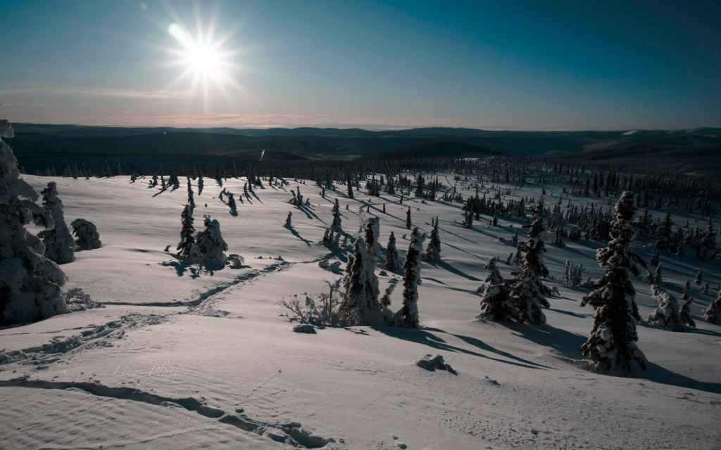
Later That summer, Rich proposes the idea of skiing Mt Sanford, a 16,237′ glacier covered volcano in the Wrangell Mountains of South Central Alaska. While I have never really called myself a skier, I always identified as a climber. I had seen Mt Sanford several times over the years and without a doubt I stood in awe of it’s size and magnitude; The first time was on a multi month bicycle journey where I found myself atop McClaren Summit on Alaska’s Denali Highway. At the time, I knew not of its existence, but there it was, certainly one of the biggest peaks I had ever seen. Over the years, it would catch my eye when on various trips around that part of Alaska, dominating the skyline when it was clear enough. Mt Sanford is the second highest peak in the Wrangell’s and rises over 11,000′ from its base, making it as big or bigger than many mountains on Earth. Only Mt Blackburn (16,390′), also in the Wrangell’s is higher. Skiing to me had always been more something to do to fill time during winter months while waiting for climbing season to sprout, but the thought of ski mountaineering up a giant Alaskan peak sounded appealing to me, so Rich and I began to hatch the plan.

We agree that late April or early May 2019 would be the time frame, since that is the standard “big mountain” climbing season in Alaska; stable weather (mostly), cold temperatures at higher altitude, and strong crevasse bridges from the tail end of winter. Any earlier and a climb is more or less considered a “winter ascent”, and later, the lower mountain becomes soggy and melted out with crevasse bridges becoming increasingly soft and fragile. We begin to sort out the details and logistics, finally settling on hiring Jake Combs at 40 Mile Air in Tok to fly us in to the base of the Sheep Glacier via Super Cub. The Piper Super Cub is the standard de facto Alaska bush plane when one wishes to get into tight spots in the backcountry. Of course there are thousands of Cessna 185’s in Alaska flying in and out of the bush, but nothing can beat the Super Cub for its ability to land and take off in a very short distance on a remote gravel bar or short strip of tundra. The downside to a Super Cub is its size; it holds one pilot, one passenger, and a tiny bit of gear, perhaps one fully loaded backpack; that’s about it.

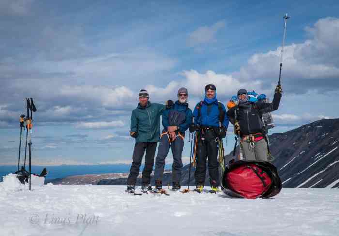
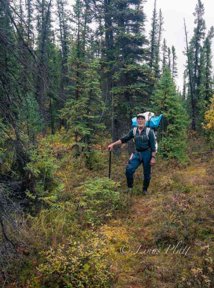
Eventually, Rich purchases a plane ticket and the deal is sealed, but a trip of this sort is safer and more fun with a team, so we ponder some of our contacts and my old friend Cameron Burns whom I had not seen in many years comes to mind immediately since he and I had recently re-connected via the good ‘ol internet. Cam and I first met in Indian Creek, Utah nearly 30 years prior, where we climbed the Lightning Bolt Cracks on North Six Shooter peak together with Steve Porcella and Sue Kemp. A couple years later, I had temporarily re-located to Boulder, Colorado from Moab, where Cam and his now wife Ann would drop by my house for social visits. Cam is an Australian and lives in Colorado still, along with Ann and their daughters. He is a world traveler and accomplished writer with a wild sense of humor and a penchant for telling stories. After inviting Cam on the Sanford Expedition, he ponders for a while, then accepts the invite. Now we are three… Danny McGee, who made the introduction for Rich and I, was also invited, but situational and family issues prevent Danny from making a commitment at this time, so his spot is left open for him should he be able to join us. In the meantime, Rich invites Jeff Rogers, a 26 year old accomplished ski mountaineer who had skied Denali a year or two prior. With Jeff’s addition, we were now a solid team of four, with Danny’s spot still available to him should his situation change. Before Jeff was brought in to the picture, it was looking like it was going to be Rich, Danny, Cam, and myself… all of us were over 50 years old and jokingly, I said “Hey we’re kinda like Over The Hill Expeditions”… and the name stuck. So when a 26 year old hot shot skier was added to the picture, I was skeptical. Luckily, Jeff turned out to be not only a great asset and expedition partner, but an excellent friend as well and I’m very happy to know him.

Once the plan was made and we had our crew together, it was time to start preparing equipment wise. Going through all my expedition gear, I realize that much of the stuff I had been getting by with for the last few years was simply not up to the task any longer. I wound up buying a new sleeping bag, down parka, shell set, and various odds and ends. The previous winter I had bought a brand new pair of alpine touring boots and had been using them in my Silvretta mountaineering bindings, with plans to upgrade to a nice pair of modern skis with proper AT bindings, but at this point, the boots I bought just weren’t working out with my feet (pain), so I sold them. My choice was to buy a whole new AT setup that would set me back a couple thousand bucks, or just use my mountaineering skis on Sanford with my double mountaineering boots. Due to financial reasons, I chose the latter. Rich also chose this type of setup utilizing an old school mountaineering package. Jeff and Cam both both would be on state of the art modern AT skis, boots and bindings. I believe it is safe to say that both Rich and I regretted this decision in the long run, as some of the outcome of the trip might have been different had we chose different ski gear. Rich, being currently employed at Hyperlight, got us a small sponsorship and each of us were sent backpacks, stuff sacks, and other goodies. Rich also managed to get us set up with a sponsorship from Mountain House who provided us with all of our freeze dried food needed for the expedition. I even set up an “Over The Hill Expeditions” Facebook page for us all to collaborate and share ideas.

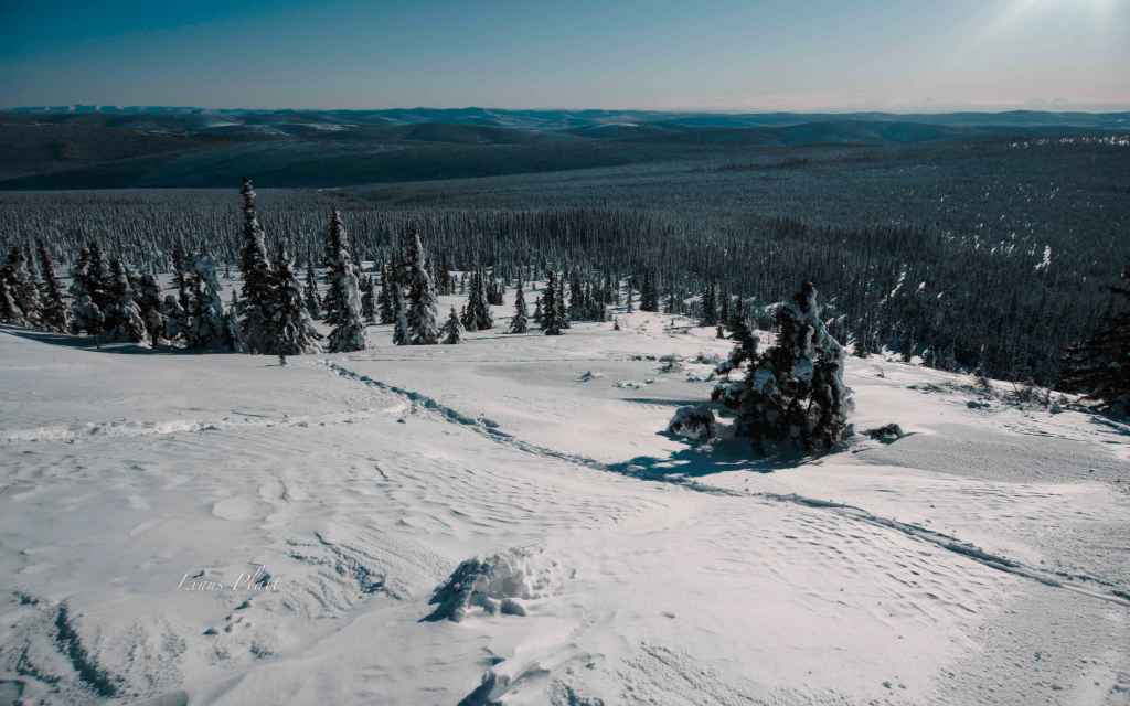
For me, going on a big extended trip like Mt Sanford ultimately represents my freedom and dedication to exploring as much as Alaska as humanly possible. Although I worked full time and now had a mortgage, I had made a promise to myself when I came to Alaska nearly a decade prior that I would not allow a normal life to interfere with my spiritual connection and vow to fully explore the planet known as Alaska, it’s people, landscapes, animals, climate, and way of life. A life in Alaska is very different than a life in 95 percent of the lower 48 (known as “The Outside” to some Alaskans). Life here has a way of commanding one to take up in self reliance and responsibility. Nowhere I have been where the Do It Yourself mentality is as crystalline as the mountain stream or surging glacier that exist here. While there are certainly pockets of similar disposition in the Outside, it is not the norm, Conversely, there are also pockets in Alaska that exhibit more of an Outside type mentality (Anchorage comes to mind). The climate and remoteness keep most people at bay, so when the tourists arrive in May and go home in August, the Alaskan landscape becomes still and quiet, and the fall colors arrive, turning Birch, Cottonwood, Aspen, and Tundra to fire hue. The crispness of the Autumn/Early winter time period is an extremely fascinating time for me in Alaska. It is a time of deep reflection and nurturing that is hard to put to word, but the crispness of the air and the stillness of the landscape prompts one to feel a deeper connection to the Earth and its beauty. Merging with the fall colors, hunting season begins, and soon after the beginning of 6 – 7 months of winter arrives, leaving the entire 665,000 square miles of unimaginable beauty blanketed in snow.

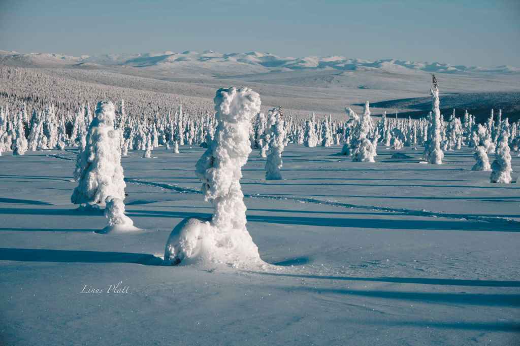
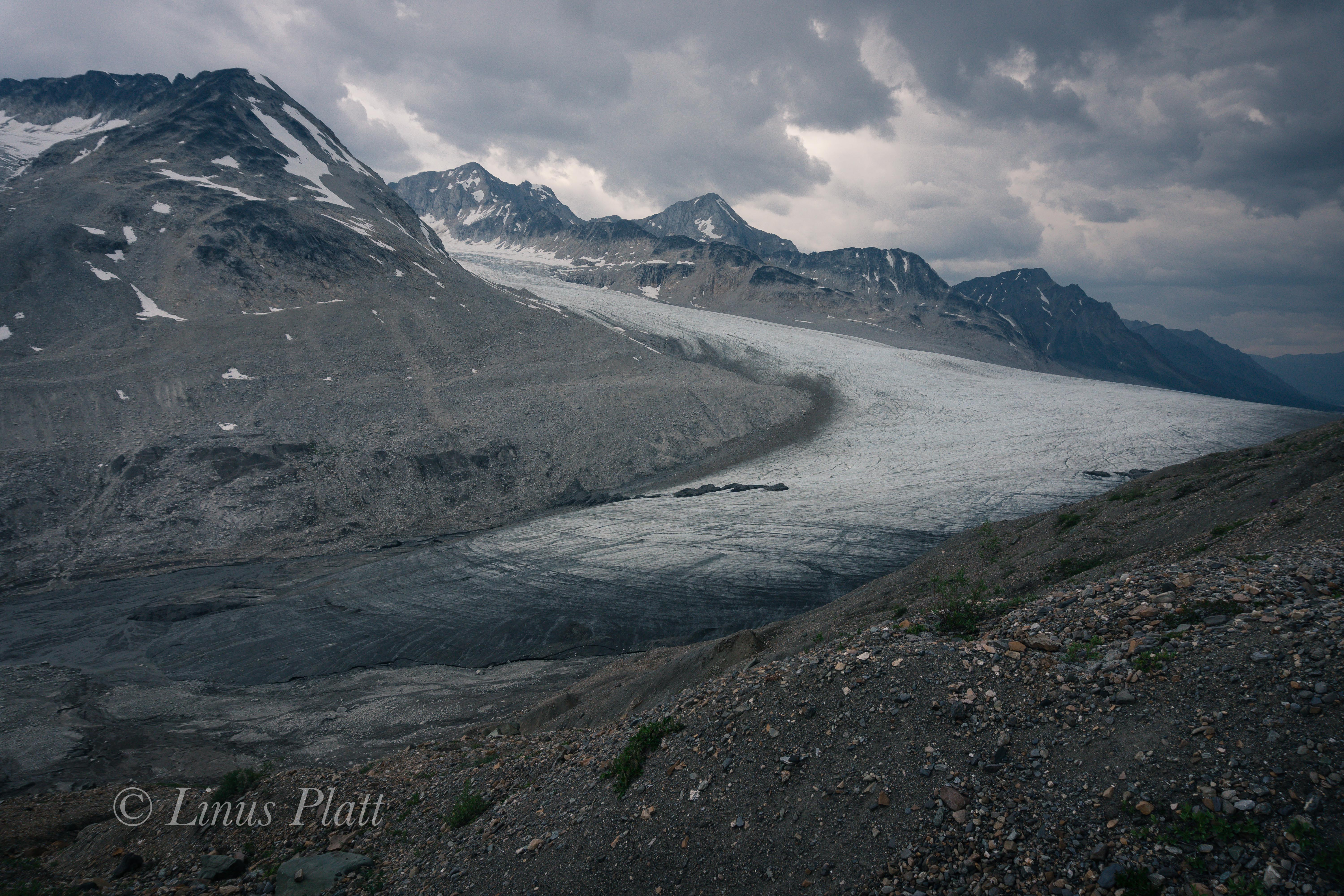
Winter is a time to work, ski, gain fitness, save money, and be thinking about Sanford. I saw a thread on the internet by a woman who had skied Sanford a few years prior, and wrote to her asking for some beta on the Sheep Glacier’s First Icefall. She got back to me with some pictures with a hand drawn line indicating the path they took through the fractured maze of crevasses and seracs. From her description and photos, the icefall looked like a route finding challenge at best and a dangerous proposition at worst. There were several internet articles and blog posts on skiing Sanford, so information was not too difficult to come by, but big mountain glaciers have a way of changing year after year. By far the most interesting essay I had read was Terris Moore’s account of he and Bradford Washburn’s first ascent in July of 1938, utilizing a dog team to reach 10,000′, followed by skiing from its 16,237′ summit. They had started in Chistochina, fjorded the Copper River, and utilized horses to carry skiis, supplies, food, and a dog sled up Sheep Creek to the toe of the Sheep Glacier, where they harnessed up the dogs and continued. It still amazes me that they managed to navigate a dog team through the maze of the icefalls without harmful incident. Since that time, it has been skied more times than can be counted; in fact it has become somewhat of an Alaskan ski mountaineering classic due to its fairly non-technical nature and gentle angle below 13,000′.

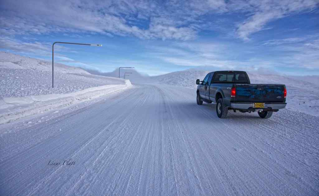
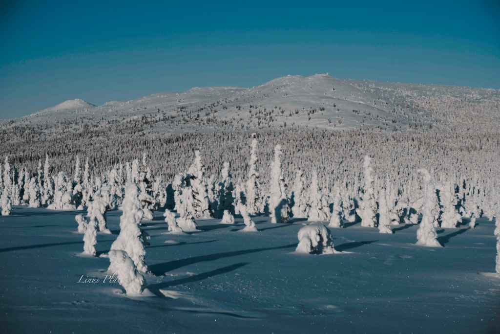
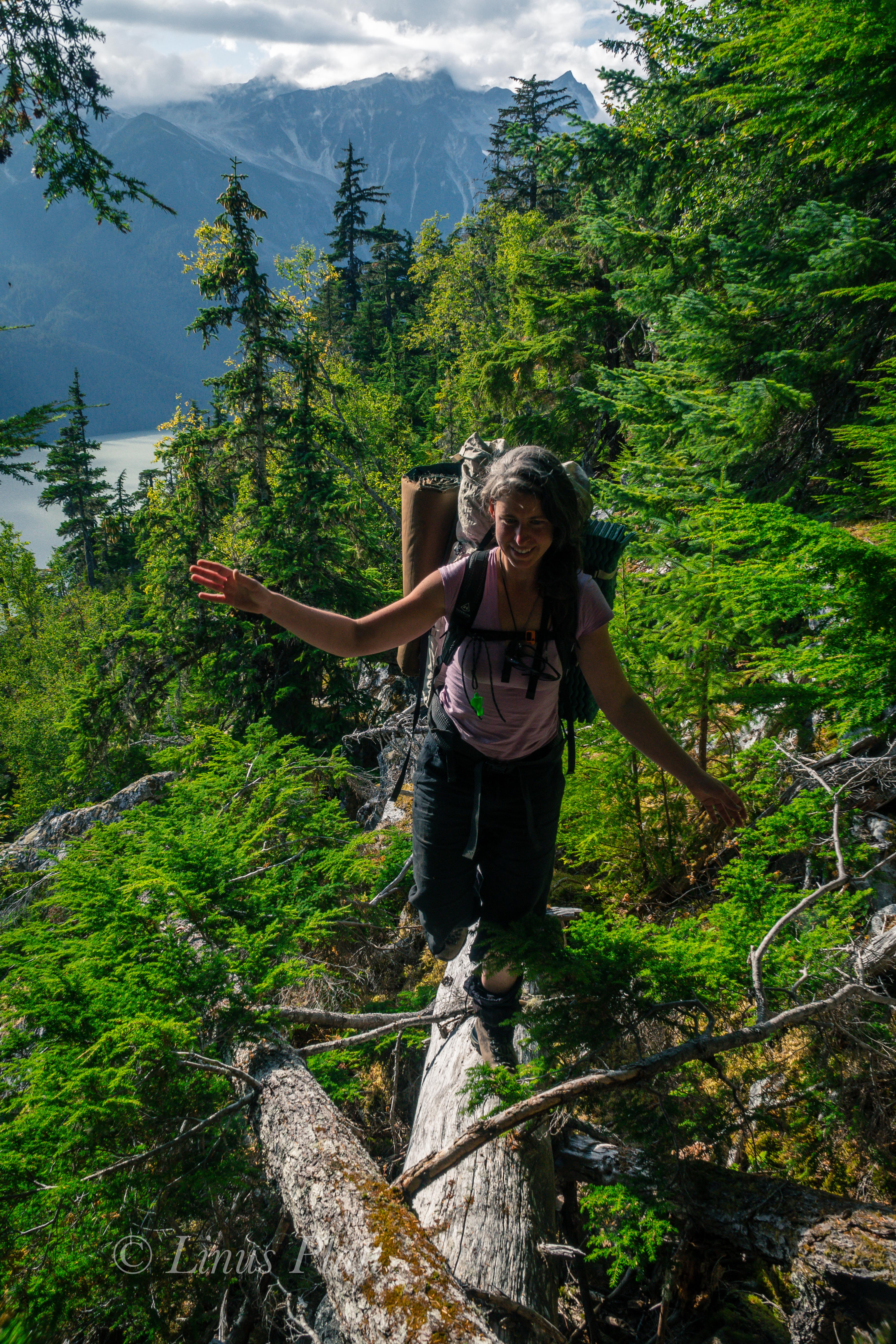
Early spring is spent working, fixing vehicles, and skiing in the Yukon and trips up and down Haine’s local mountain; Mt Ripinski rises right from town out of the ocean to an elevation of about 3600 feet where a myriad of ski and snowshoe trails lead to backcountry cirques, alpine ridges, couloirs, and summits, and being at this latitude and proximity to the Gulf of Alaska, receives many feet of snow every year. Aside from being non-glaciated, Mt Ripinski and the surrounding coastal peaks make a good training ground for the bigger interior mountains of Alaska and the Yukon. In late April, I leave Haines, driving north in my pickup headed for Anchorage where Rich, Cam, and Jeff would be flying to. I had been looking forward to this drive as much as the expedition itself; I had taken enough time off from work to allow several days of alone time for exploring the great Alaskan landscape at my leisure. Having free time in Alaska with no work commitments at hand, with vehicle and equipment at my disposal to do what ever I want is one of my greatest satisfactions. For me, driving slowly through Alaska, stopping frequently, hiking up this hill or that, fishing a small river, and camping where one pleases is paramount. Being free in Alaska is the ultimate in personal freedom and nothing else comes even remotely close.

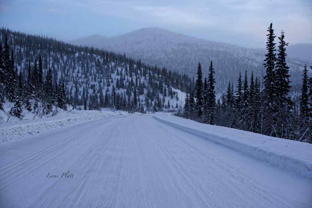
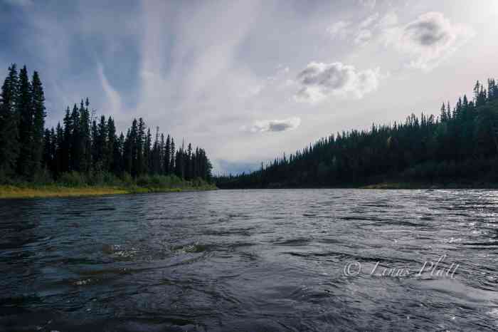
Driving over Haines Pass, where the Takhinsha and St Elias mountains collide, I spot a thickly furred Fox lying in the snow beside a tussle of Willow; it does not look injured, but merely relaxing perhaps. I pull over and approach the creature and it lifts its head to look at me and simply yawns. I speak to it in gentle tones and wish it farewell as it curls its tail over its nose for a slumber. I zip Past Desdeash Lake and soon I’m topping the truck’s fuel tank in Haines Junction. I’m not sure where I’ll spend the night, but I find the temperature near Beaver Creak in the Yukon hovering right around ten degrees Fahrenheit, so I keep driving, thinking warmer temps are coming. Pretty soon I’m in Tok, where it is almost always much colder than any other place in the state, but on this lucky day it is 35 degrees, so I opt to head to one of my favorite standard camp spots in the area at Yerrick Creek just 20 mile north of town. I had brought my packraft on this trip because I had always wanted to hike up Yerrick Creek to the foot of the Alaska Range and paddle back down to the Alaska Highway, but of course now at this time, it is still frozen. Perhaps on my way back after Sanford it will afford a paddle. Back in Tok the following morning, I hit the market and pick up some supplies and head down the Tok Cutoff towards Anchorage. The Tok Cutoff is a short 125 mile stretch of glorious highway connecting Tok to the Richardson Highway just north of Glennallen; it slices through some of the finest countryside in the state, where it follows a corridor right smack through the middle of two of Alaska’s major mountain Ranges. When one is heading south west on the Cutoff, The Wrangell Mountains are on one’s left and the Alaska Range on the right. I find a typically free and spectacular camp along the Little Tok River, catch a nice Grayling for supper, and revel at the days growing longer each day. Winter has left the building.

A couple days of screwing around and suddenly I’m in Eagle River about 10 miles north of Anchorage looking for a place to camp. I like to tell people that there is generally no need to pay for camping in Alaska, since there is an abundance of free and wild camping to be had nearly everywhere… except anywhere near Anchorage. Personally, I can’t stand Anchorage, or Anchoraugua, as some people I know sometimes call it. Camping is always a problem whenever I am near here. As the saying goes “The best thing about Anchorage is that it’s only an hour away from Alaska”. It’s true, yet to me, it is a congested slice of crime, traffic, and sprawl. It is a fairly beautiful place however, sitting at the foot of the Chugach Range and reminds me vaguely of Salt Lake City. It is desperately crowded (for Alaska) and I am always on edge when I am here. But finding myself in Eagle River, which is essentially a sleeper community of Anchorage, I decide to just grab a cheap motel since Rich comes in tomorrow. After neighboring crackheads keep me awake for portions of the night, I stagger out in the morning and hit a diner for coffee and grub and check on everyone’s flights.

Rich Page and I had never met, Jeff Rogers and I had never met, and Cam Burns I hadn’t seen in 30 years. An interesting expedition lineup I thought to myself as I entered the airport terminal to grab Rich. Before I get 10 feet in the door, I spot him; sporting a ball cap atop a head of long gray hair, feet adorned in flip flops, and a big grinning smile plastered to his face. After we grab his massive duffle bag full of expedition gear off of the carousel, we head to the Air B&B he had rented, drink beers, grill steaks, and get to know one another. I immediately like Rich and there seems to exist between us a certain bond regardless of having just met. We have a lot of laughs telling stories and after the last beer is finished at 1am it is time to crash out; Cam and Jeff will be arriving tomorrow.

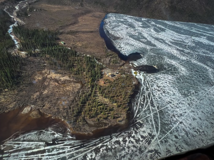
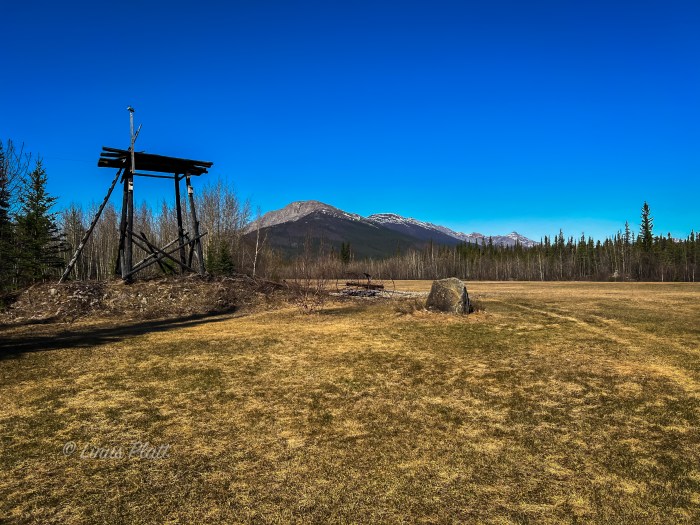
Cam flies in at 2 pm and I go in the terminal to grab him while Rich waits in the truck, warding off any potential police waving a ticket book around. Cam is taller than I remember him being, appears to be about 6′, 2″, and like Rich has a massive grin on his face when we greet. We load the truck and head back to the Air B&B; Jeff will be here soon and we can all settle in to prep for the trip. Hours later, Jeff lands and takes a taxi to the house, saving us from having to pick him up. Spending the next couple of days running around Anchorage is taxing on me; not only do I have absolutely no idea where I am or where I am going most of the time, the traffic is overwhelming. In Haines, there are exactly zero stoplights, and if you have to wait more than 20 seconds at a stop sign it is a rare occurrence. But here in Anchorage, we are running all over the place looking for a pair of puffy pants for Cam, a foam sleeping pad for Rich, and buying all of our trip lunches, snacks, booze, and other extras. Finally, completion is made of these tasks and we settle in at the house to repackage the mountain of freeze dried breakfasts and dinners courtesy of Mountain House. Re-packaging these meals saves a tremendous amount of space and a tiny bit of weight. We pack for 15 days on the mountain, plus have another box to stash at basecamp at the landing strip a couple of miles below the toe of the Sheep Glacier. In the morning we hit the road, heading up the Glenn Highway toward our destination of Chistochina, where there is a small airstrip next to the highway where will meet our pilot Jake. Also in Chistochina is the Red Eagle Lodge, where we are certain we will spend at least one night.

One of my greatest thrills is being tour guide on these trips when folks from down south come up for a visit, and heading up the Glenn Highway into the great vast openness of Alaska’s truly face melting scenery, I point out this and that; we pass the Matanuska Glacier in the heart of the Chugach Range, stop at Eureka Summit, among other places frequently to observe various monster peaks and glaciers off in the distance. We stop to observe a small herd of Dall Sheep on a hillside near the Chikaloon River. Soon it is raining, and we continue on to Red Eagle, where the weather is simply nasty and cold. We decide to rent a one room cabin and settle in for the evening, listening to the downpour outside. A call to Jake in Tok reveals a no fly condition as things are currently. We will check back in the morning for an update. Anticipating the weather clearing and a monster day tomorrow getting base camp established, I am concerned, as I often am with getting proper sleep, and Cam offers a solution.

Cam hands me a couple of pills “for Sleep” he says. “I Guarantee that you will sleep”.
So after dinner and a couple of beers, we pack our packs just in case the weather works in our favor in the morning, I swallow the pills Cam gave me, and we all settle in. In the timeframe of a light switch engaging, I slowly peel my eyelids back to see everyone up and about, dressed, packed and ready for action. Seems they had been trying to wake me for a couple of hours. I feel like shit, and can barely walk once out of my sleeping bag. My mind is a haze that only pharmaceuticals can induce. The next hour is spent simply getting oriented, and I pray that we do not fly today. “What in the hell were those Cam?” I ask. “Anti-depressants Mate! They help me sleep…” he replies.

Unfortunately for me and the unbelievable “pill” hangover, the weather is improving slightly, and Rich talks with pilot Jake in Tok, and afterwards walks over and says “Jake will be here in a couple of hours”. So we pack the truck, get our gear together, and suit up with superhero mountaineering regalia before heading to the lodge for breakfast, that way if Jake happens to show up early, we are ready.

Richard and Judy Dennis, the owners of Red Eagle Lodge, have done a fine job of making us feel at home… Richard, a former educator and Alaska bush pilot has lived in Alaska for over 3 decades and his wife Judy, a registered nurse, has spent a great deal of time working in the African bush prior to coming to Alaska, where they discover the Red Eagle Lodge in 2006 and sign ownership papers in 2007. They have worked diligently to make the Red Eagle into what it is today, befitting a reputation for a pleasant and rewarding stay for travelers on the Tok Cutoff.

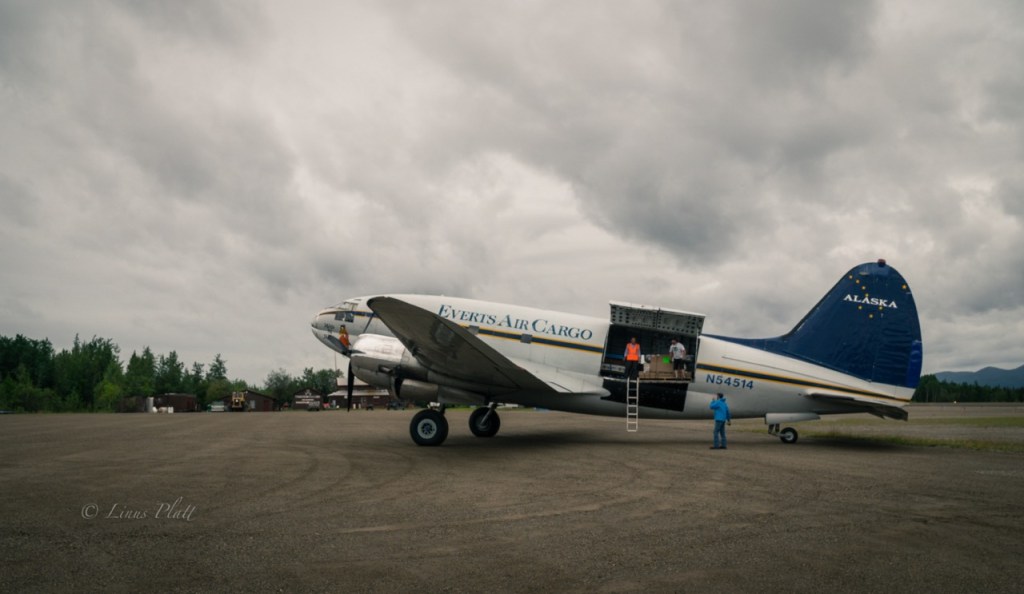
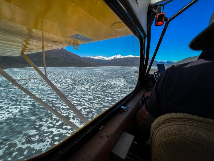
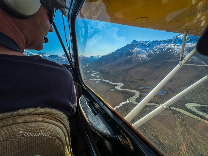
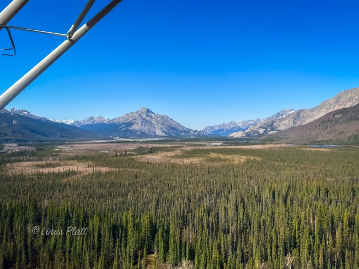
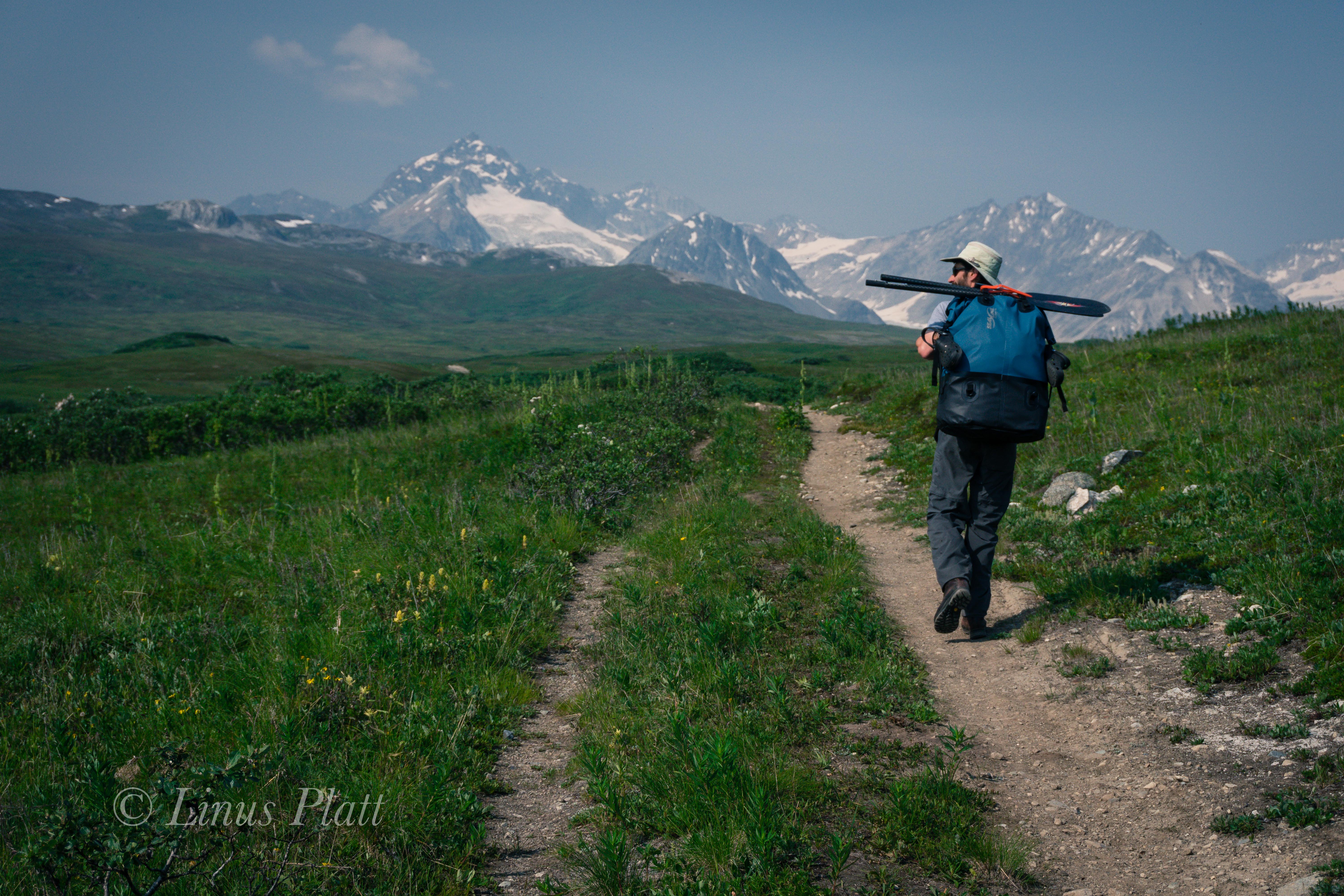
After breakfast with Dennis and Judy, we finish packing the truck and relocate it to a spot adjacent to the lodge where it will be out of everyone’s way for the time we will be up on the mountain. We then make a pile of the gear we’ll be taking. When Jake lands, he will be flying us in one at a time each with a backpack. After all of us have been flown in, he’ll make one more trip for our remaining gear for 5 trips total. It is only about 35 air miles from Red Eagle to the Sheep Glacier landing strip, which is but a gravel area that Jake has cleared by hand just enough to get his Super Cub to land. We spend the next hour or so milling about; excited for the flight in. As far as I know, I’m the only one in our group who has ever flown in a Super Cub; the year previous, Angela and I had flown with Drake Olsen of Haines in his Super Cub into the upper Tsirku river drainage for a 3 day packrafting trip down the seldom visited Takhin River.

Jake had left Tok about 45 minutes earlier and at just about noon, I hear the distant but always familiar sound the Super Cub makes; Jake will be landing momentarily. The Super Cub always amazes me in the very little distance required for a take-off or landing, and Jake piloting the little craft today is no exception as he comes in fairly high, then suddenly drops down steeply and rolls the machine to a stop right in front of us. Rich, Cam, and Jeff all have this shit-eating grin plastered to their faces having just seen how impressive it’s landing capabilities are and anticipating the coming joy ride. It’s decided Rich will go in first; Jake loads his expedition pack into the tiny area behind the passenger seat, then Rich climbs in, followed by Jake. The little yellow beast fires up and soon another prime example of the Super Cub is at hand as Jake taxis the machine to the start of the road side landing strip, adds heavy RPM’s, and they are off, gaining speed in an incredibly short amount of time with wings abruptly airborne and elevation rapidly gained; soon they are gone beyond the tree tops, only the faint hum of the engine audible as it slowly dissipates into the still Alaskan air.

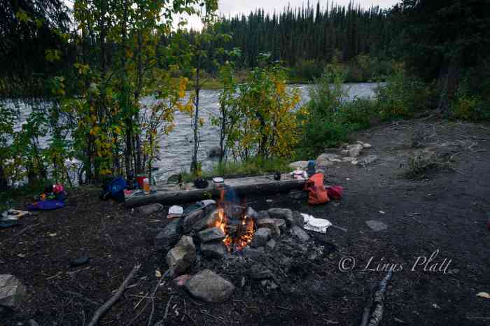
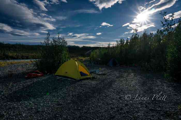
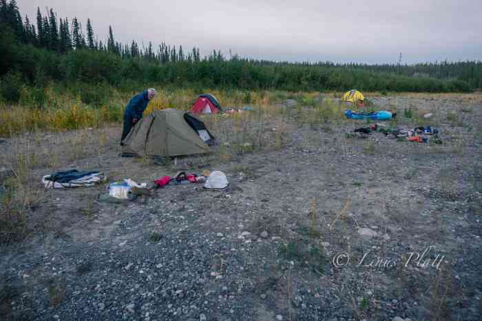
Each flight takes about an hour round trip, and by late afternoon the 4 of us are at the makeshift gravel landing strip along Sheep Creek, an unknown number miles from the toe of the Sheep Glacier. Jake takes off for a fifth and final trip to grab the rest of our gear at Red Eagle and we use the time to get tents setup and become organized. By the time shelters are in place, Jake comes around again and we take some group photos with Jake included; we shake hands, and Jake, back in the air, does a nice low 180 tipping his wings at us as he slowly gains casual elevation before disappearing behind the low peaks down valley and is suddenly gone, leaving us there at our makeshift base camp to the silence of the snow and the rocks. After the sting of the silence has worn down to an acceptable level, we continue organizing and getting things setup for a possible stay here at basecamp as the weather report on the GPS indicates some snowfall this evening. After our initial chores are accomplished, someone opens up a bottle of whiskey and after a few rounds of shots, we decide to don skis and skin up a nearby hill to catch a few turns. Snow conditions are quite terrible really, and we are all slightly inebriated. Being somewhat of a lousy skier to begin with, I did not fare well. Neither did Rich… Cam fares slightly better, and Jeff, being the young hot shot skier he is, cuts a flawless line of turns down said hill like it’s just another day at the office, because it is.

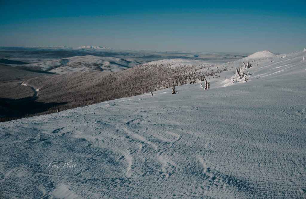
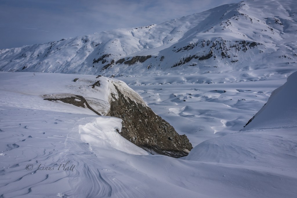
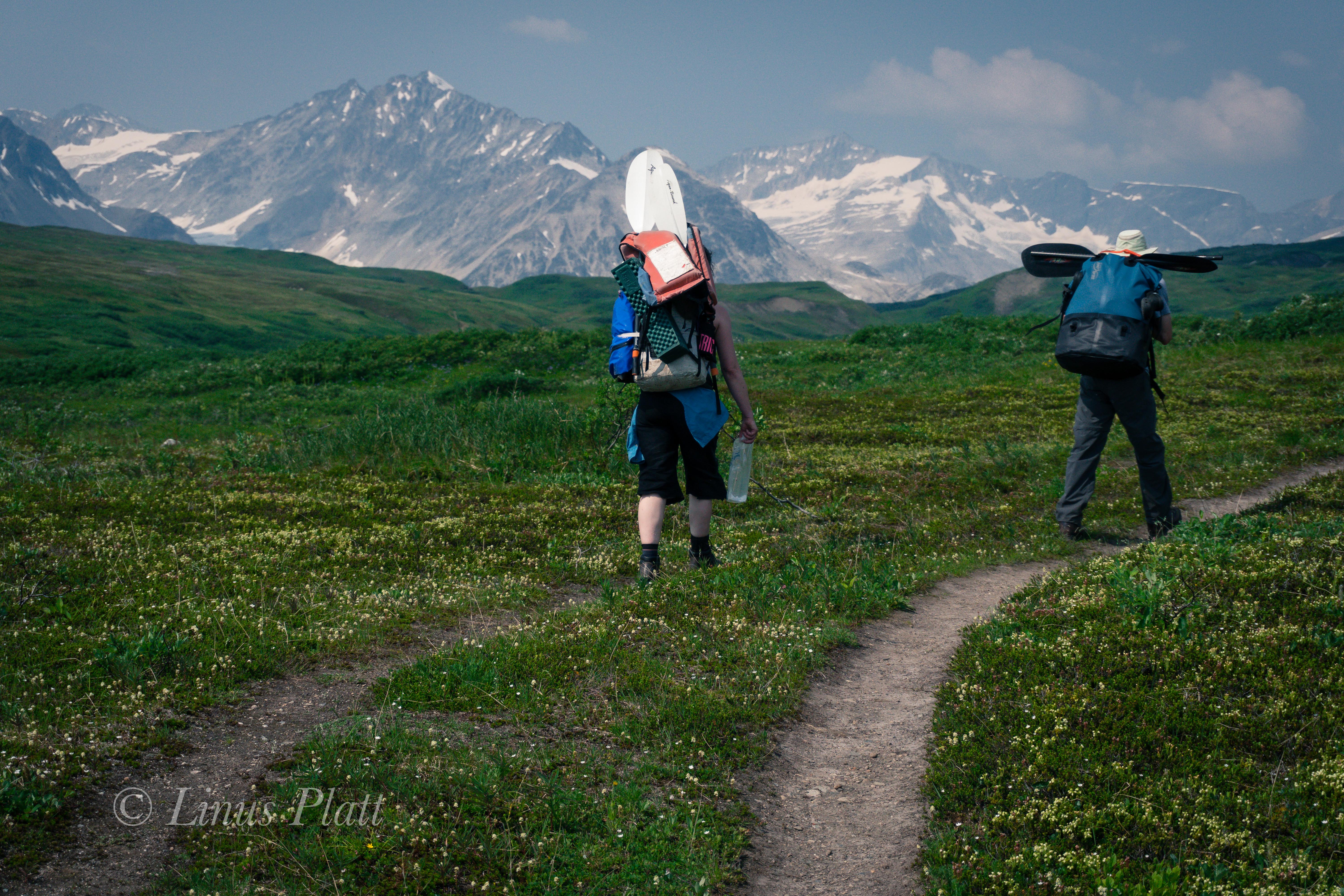
That night it snows a bit, and the morning brings cloudy, but snow free weather, so after a hearty breakfast of pancakes, sausage, and coffee, we pack up a load and see what the upper reaches of the valley reveal, hoping to get to the toe of the glacier and make a cache. We are utilizing duffle bags wrapped in plastic tarps for their slippery sliding capabilities and pulling them like sleds in classic “drag bag” style. We meander up valley, pulling our loads through the thin snow and every now and then engage in a wrestle getting the bags through sections of rocks and embankments. Soon we are faced with a choice; we can either stay low and follow the drainage, pretty much guaranteeing a certain, but possibly long ski to the toe of the Sheep Glacier, or, as at least two of us believe, a possible shortcut up and left. We choose the latter, but after a dead end up high amongst volcanic outcroppings, we descend back to the creek where we commit to the flattish trudge continuing up valley. After a couple of hours, we come to a small headwall of sorts, where we decide to make a cache amongst the large pumice boulders. We have fallen short of our goal of making it to the glacier, but everyone is feeling tired and the decision is made to return back to basecamp.

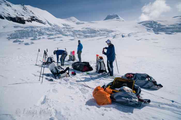
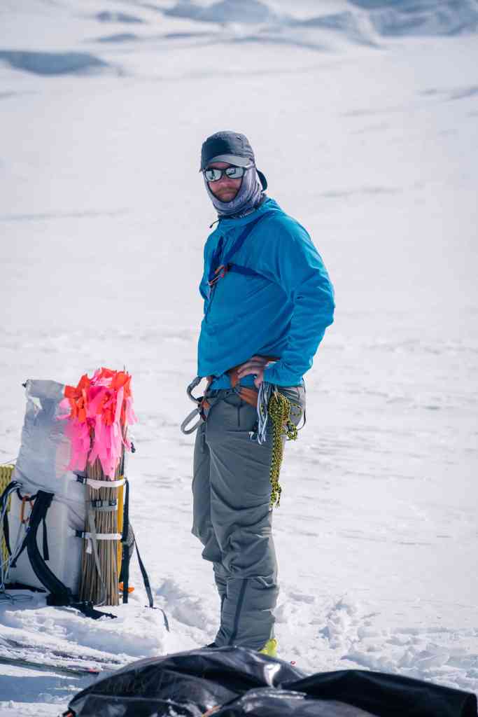
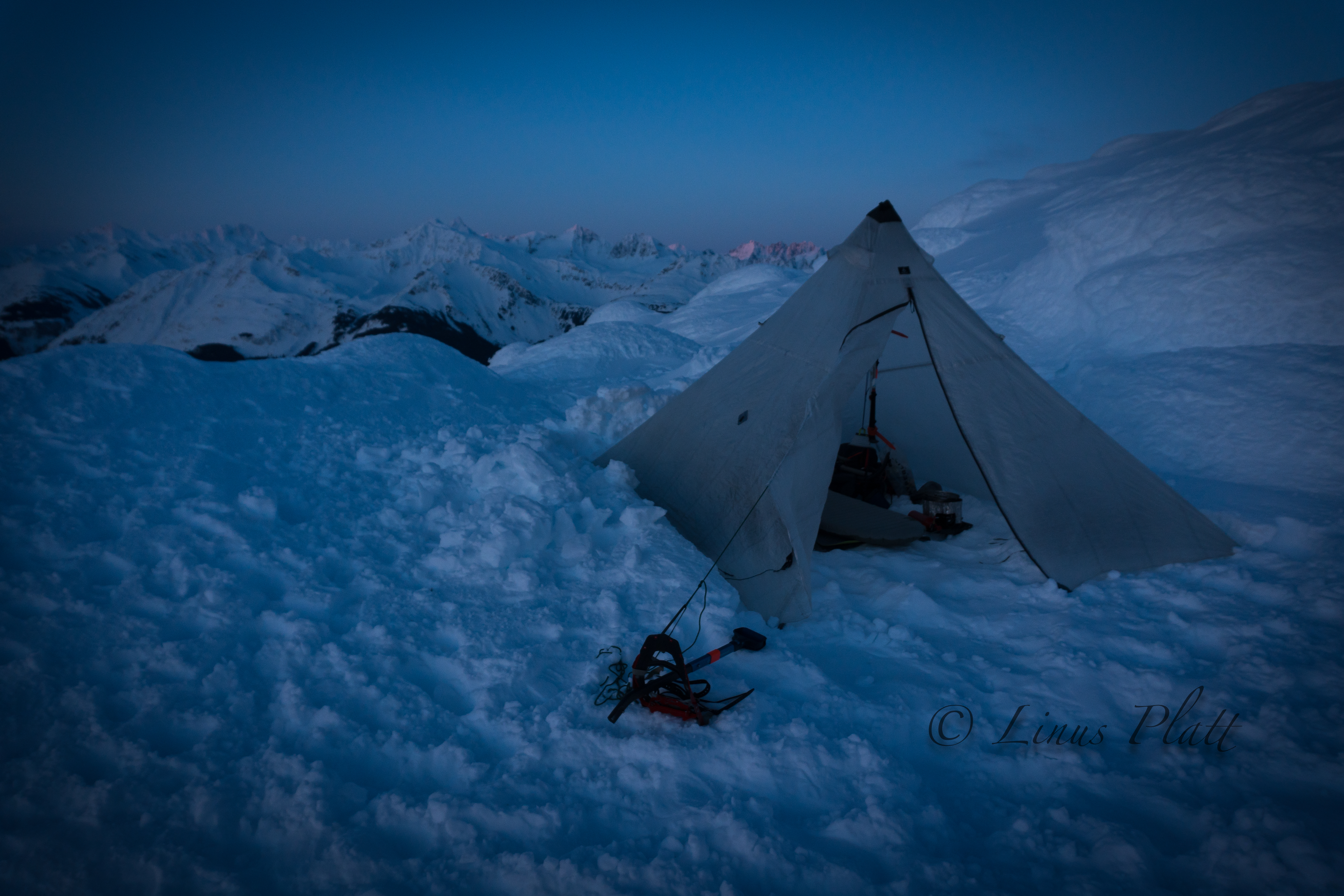
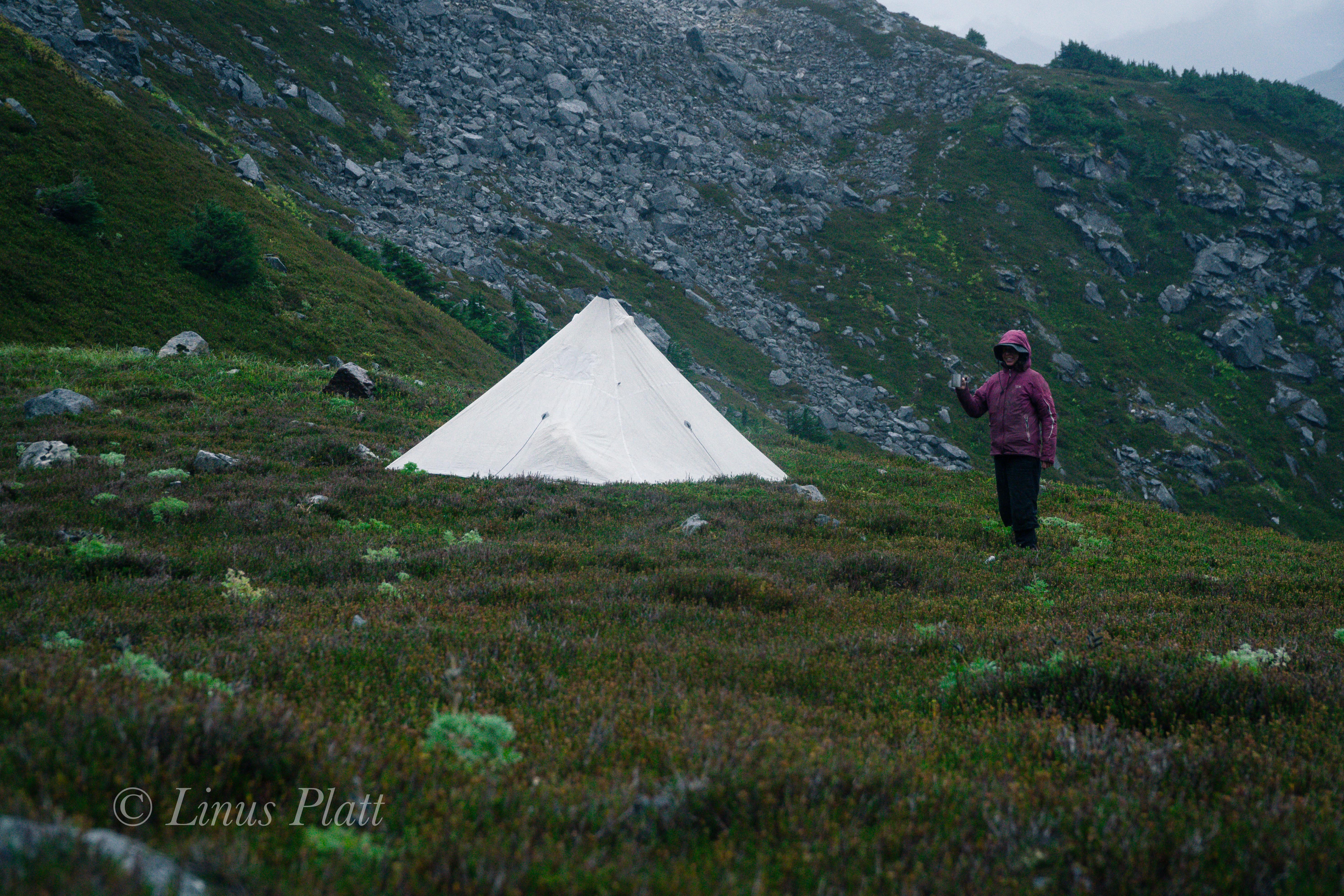
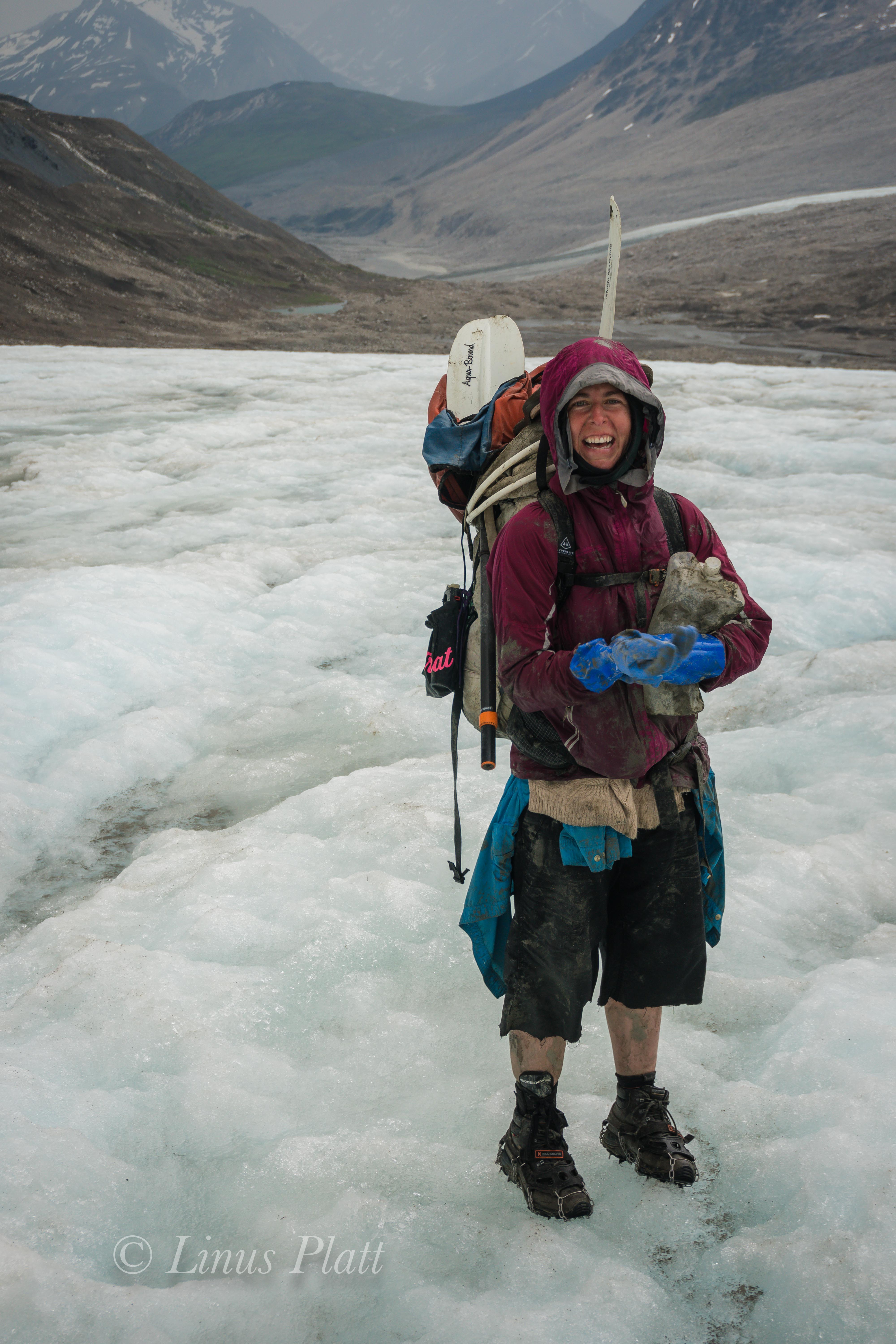
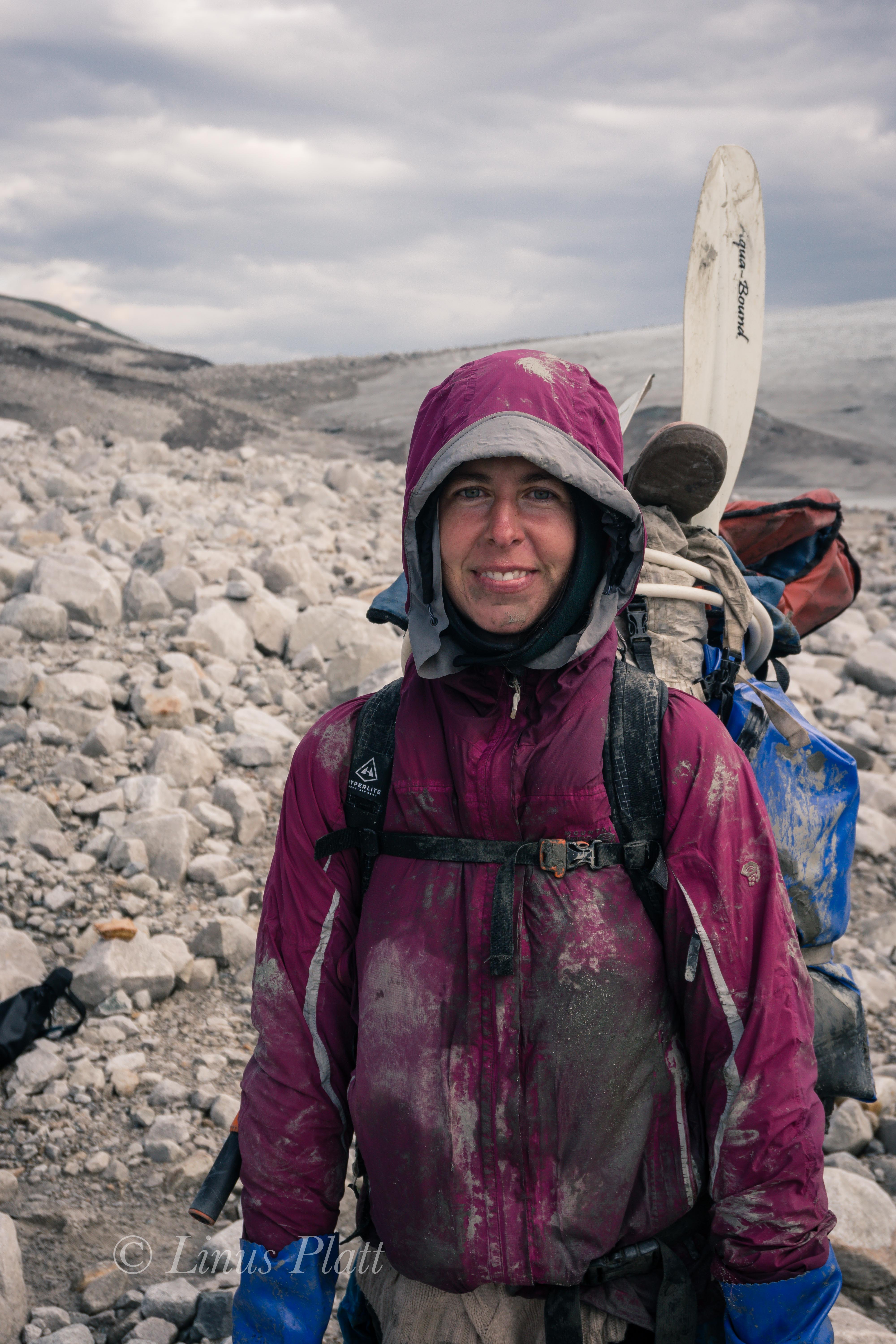
That night it snows again, but we wake to blue sky, sunshine, and mild temperatures. After another round of breakfast decadence, we pack up everything but a spare stove, extra fuel, and a box of food, which we make a cache of and pile rocks atop as to deter animals from pilfering. Our packs and drag bags are full and heavy, and we begin a slow trudge once again up valley. Not wasting time with meandering this way and that, we arrive at our cache in a reasonable time frame, where we decide to grab only a few items and continue on to the toe of the glacier. After topping out above the cache we expected to be near the glacier, but were surprised to find a long flat valley of pumice; according the topo maps we had, the glacier had been here sometime in the last 50 years or so, but it has receded about a mile back. We drop our load here and make a dash down the boulders to the previous cache which was only about a quarter mile distant and ferry that gear back up to the north end of the pumice flats. We make a temporary stash here and continue skiing south across the pumice flats towards the now visible glacier. Not knowing what to expect in regard to a location for an advanced basecamp, we figure it will just all come together as needed. Skiing in and out of boulders and creek drainages, the toe of the Sheep Glacier is directly above us, and it getting late in the day, we decide that here and now is the place for camp, since the weather is deteriorating and we have no idea what lay above on the ice. In fact, the wind is picking up as Rich, Cam, and Jeff proceed to setup our tents, while I make the commitment to ski back across the pumice to retrieve the last of our gear stash. Skiing back with a 100 pound pack plus a drag bag makes for some strenuous work and the going is slow, but by the time I make it back, they have three tents setup – Cam and Jeff each have solo tents, while Rich and I share a big expedition tent, plus we have 4 person Hyperlight UltaMid with a dedicated pole to serve as a cook hut. This “Pumice Camp” as we have not-so-affectionately dubbed it is a terrible place to camp; it is made up entirely of pumice rocks ranging in size from golf ball to Volkswagen, and covered in just a few inches of barely skiable snow, making purchase for tent stakes grim at best. We have brought along dedicated snow stakes for use higher up, but manage utilize them here in the frozen pumice. I set about to getting the ‘Mid erected so we can fire up the stoves for hot drinks. Getting the mid setup is a difficult task, as it absolutely relies and solid staking of its 4 corners. Additionally, since the ground (I use this word loosely) is nowhere near flat; there is a hump in the middle making the single center pole too long. I manage to get it setup just as the big winds started coming down from the glacier, gaining velocity as it hits the pumice flats where by the time it gets to us feels like a freight train hitting us. I grab my camera, intent on attempting to document this expedition, which quite frankly is generally a giant pain in the ass. I pan the camera around camp as the wind accelerates, and then hear a virtual explosion of wind followed by seeing Rich’s big expedition tent tumbling across the pumice full of our gear. Rich, running as fast as he can in mountaineering boots to catch our needed survival supplies, I continue filming. As he drags back the tent, he shoots me a rather unaccepting look and asks if I wouldn’t mind giving him a hand. I holster the camera and sheepishly apologize for not dropping everything and running after the tent with him. Of course, Rich was right and that is certainly what I should have done, but it was way hard putting that camera down once the action started. After getting the tent back up and making some repairs to the ripped fly with duct tape, we manage to get the stove going inside the mid and brew up. The wind is ferocious, and the rocky surface we are sitting on is not enjoyable with all 4 of us cramped in with 2 stoves running. After we eat and drink hot liquids, the wind comes now in heavier bursts, one of which simply flattens the ‘Mid with us in it. We scramble out and decide to just let it alone and stack rocks on it to keep it from blowing away and retreat to the tents to weight them down as well, where Rich and I spend the next 14 hours sleeping and wondering what the upper mountain was going to be like.

During the endless daylight night we listen to the wind attempting to shred our camp into oblivion, sometimes putting a leg up on the pole structure to help stabilize the shelter from collapsing, then later drifting off into a fitful sleep only to be woken by and variable and treacherous gale outside; additionally, the wind has a serious chill to it since it as it rolls off the bare ice of the lower glacier just above us. Eventually, the wind settles down and we sleep into the later hours of the following morning, where I awake to find Rich outside setting up a makeshift kitchen outside of the collapsed ‘Mid. I crawl out and head over to the frozen creek where Rich had broken through the ice to expose the water below; I fill water bottles for drinking, coffee, and breakfast. Jeff is out of his tent, followed by Cam and as we all set down upon the pumice to collect ourselves, it occurs to me yesterdays events took a small toll on us all as we all appear somewhat disheveled; from the looks of it, none of us seem to have any affinity for this Pumice Camp, we all vow to get moving after breakfast and get this wagon train up on the glacier.

After breakfast, we spot a group of three skiing toward us; carrying full packs and sleds and exhibiting the same look on their faces that we had only worse. They told us of a night spent at about 11,000′ during the hurricane force winds that ravaged the mountain, and describe the conditions up high as “Himalayan”. They had had enough and were retreating to the gravel bar where they hoped to send a GPS text to their pilot to come and pick them up. It occurs to us that we did not even know there was another party on the mountain, but after they ski off down valley, it seems reasonable that we are entirely alone on Mt Sanford.

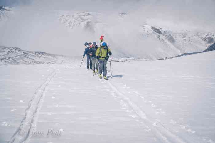
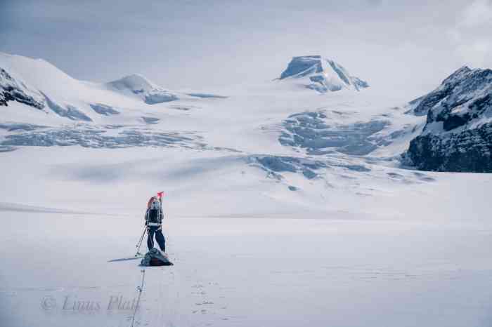
The plan all along, for better or worse, was to climb Sanford in a more or less “expedition style” versus going lean, fast and light. This method generally allows, or even requires that each incremental advancement up the mountain be made twice, or a “double carry” if you will. This also allows for the notion of “climb high, sleep low”, a technique that allows one to become acclimated to the high altitude, there alleviating altitude related illness. The downside to this approach is more gear, more weight, more work, and more time. I personally prefer the “fast and light” approach, but on a big peak like Sanford, this approach has its advantages. Today’s progress out of Pumice Camp will be no exception, and we pack up the supplies we will need higher, flatten our tents, leaving most of our camp behind, and set out on skis to gain the glacier and make another cache. The weather has improved for the moment so we capitalize on this and get moving. Soon we are at the toe of the glacier and as luck would have it was covered in skiable snow, rather than bare ice I was expecting which would have required us to put on crampons and carry our skis, slowing our progress significantly. Skiing up the lower glacier was a cinch and soon we emerged upon the flat and mildly crevassed lower Sheep Glacier, where only a mild breeze was felt. We don our harnesses and rope up; Conditions are great with the sun pouring out from the sky, we ski further towards the First Icefall, where we come upon an abandoned camp that the previous party we had built on their way up the glacier. Consisting of a large ring of snow blocks to protect tents from the ferocious wind, it has a kitchen pit dug into its center, but the whole thing is in bad need of repair. We stash our loads in the kitchen pit and ski down glacier back to Pumice Camp, where we all dreaded to spend another night. Upon arriving back at the rocky hell hole of a camp, we are feeling tired, but good, and a nice long celebratory supper and whiskey cocktails was to be had. By the time we all went to bed, the conditions were eerily calm; warm even.

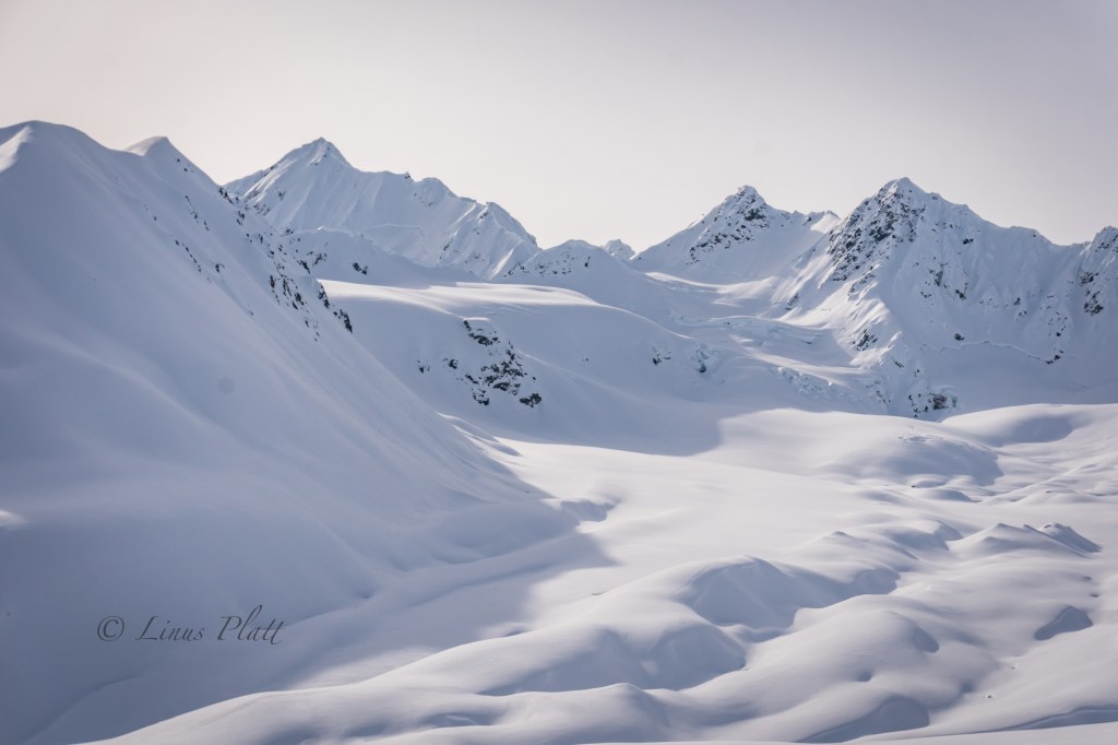
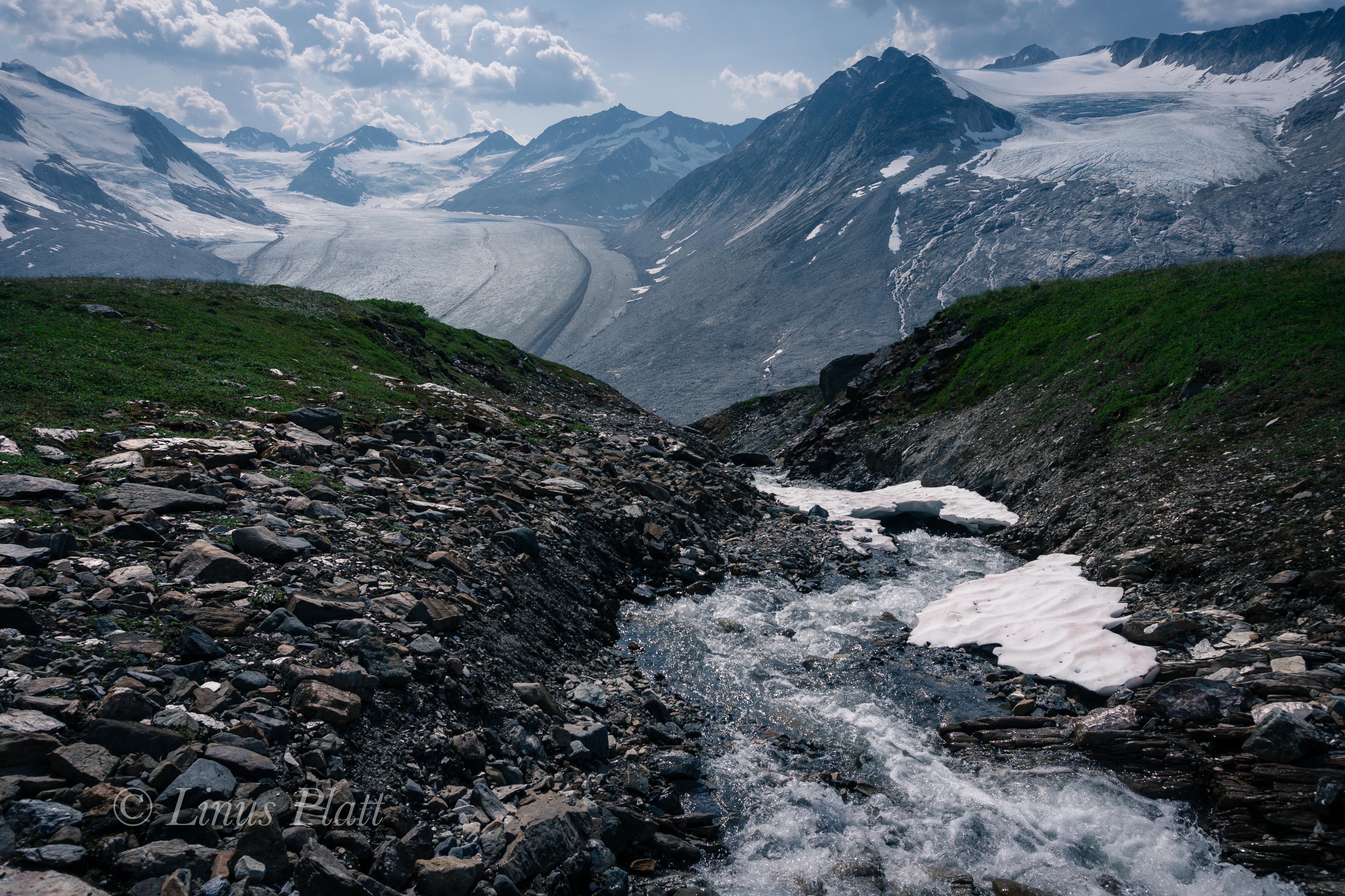
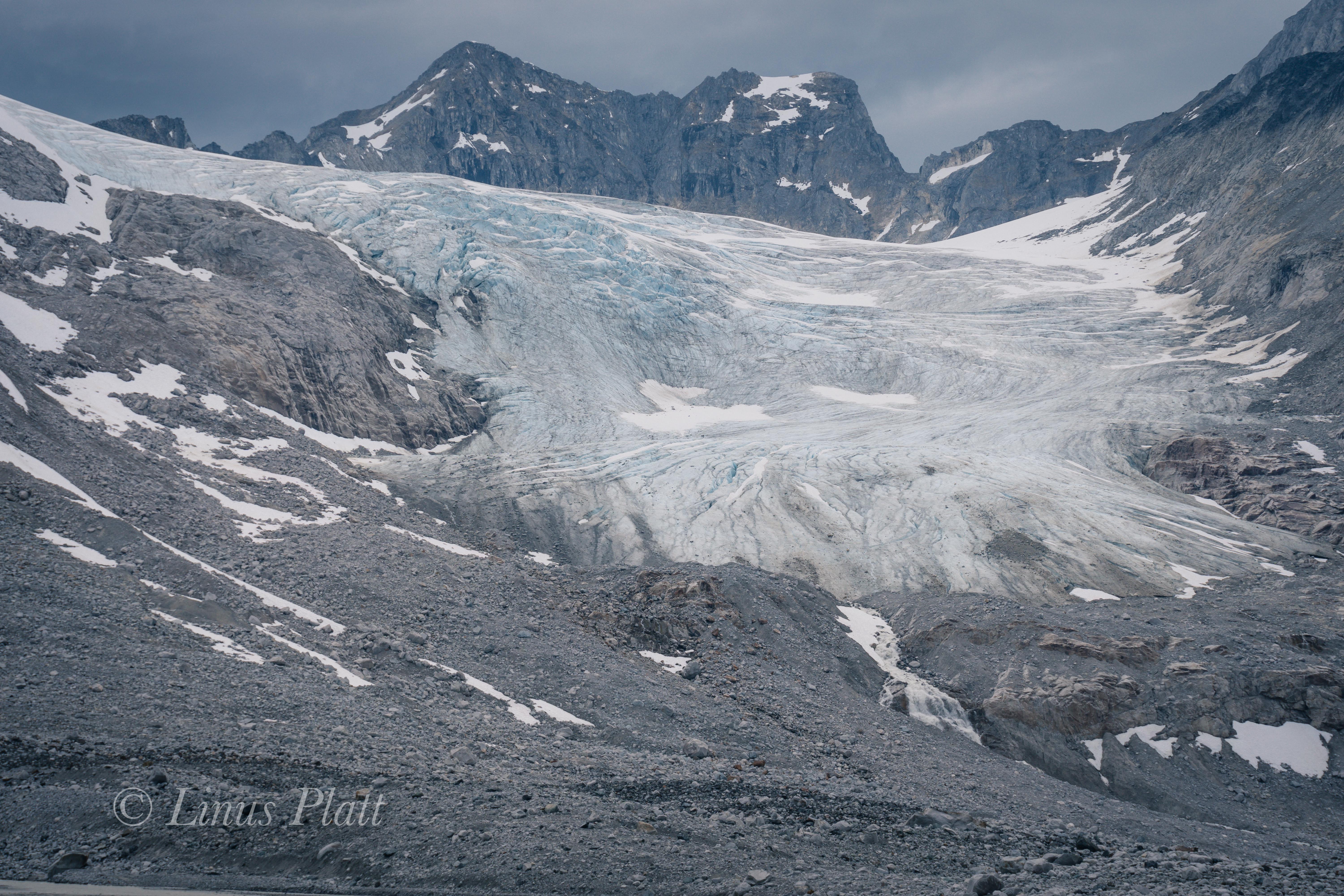
I sleep exceptionally well that night and morning finds us experiencing fortuitous conditions and a casual breakfast followed by an acceptable late start. By the time I roll out of the tent, Rich is firing up the stoves in the 2-3 inches of fresh snow that had fallen during the night. About an hour later, the sun peeks up behind the upper glacier and it appears we are in for a glorious weather day, and after breaking camp, we bask in the sun for a spell, lay out the solar panel to charge phones and GPS, and check on the weather forecast. Sitting upon a semi flat pumice boulder in the sunshine feels fantastic; it’s the first real comfort any of us have felt since leaving the gravel landing strip a week earlier. By noon we are traversing the lower tongue of the glacier; our skis gliding crisply through the fresh snow, the only sound audible are climbing skins gliding and crunching, a wisp of breeze sailing through our jackets from time to time. We emerge on the flat glacier above; this time with all of our gear and ready for the tasks ahead in general and the navigating of the First Icefall in particular. Rich and I share a rope, Cam and Jeff on another. Eventually we find ourselvesIt at the abandoned snow block camp where we must repair its deteriorating condition. After some time cutting dozens of blocks with our snow saw, we had stacked the walls high enough for all three of our tents to be sheltered adequately from the monstrous winds we have been experiencing on this trip. Next, we widen and deepen the kitchen pit, build a couple of steps leading in to it, begin setting up our new “nylon ghetto” which we figure under traditional standards would be called Camp I. Once tents are up and gear organized, we head down glacier for a quick jaunt to collect the gear and wands left earlier. The lower portion of the glacier where we are is lightly crevassed and are generally very small; the situation is a such that I would feel extremely comfortable skiing unroped, but in the interest of safety and group continuity, we remain roped and with crevasse safety equipment engaged, creating a mind set that this is how life on any glacier is. The fact of the matter is that even seemingly tame sections of a glacier can be extremely dangerous, especially if one takes a cavalier attitude by making assumptions that it is safe. Back at camp, I study the landscape ahead, observing the icefall we must tackle tomorrow. The aerial photographs I had seen recently indicates that the glacier has changed significantly since the pictures were taken. In the photos, the icefall was a massive, chaotic array of giant crevasses and enormous seracs sized bigger than the average house; in fact the photos indicated we may have difficulty finding a way through the quandary, but from my perspective here at Camp I, it does not appear to be what it once was; the glacier at this level has melted enough to smooth itself out and undermine the potency of what is commonly referred to as The First Icefall. That evening at just around midnight, the daylight night turns into a short lived dusk; the Nunatak at around 10,000 feet becomes an unpropitious orange, and the sinister line of menacing seracs atop of the West Face shift a glaring purple timbre as if to amplify their threat to anything below. Exhaustion takes over and soon camp is still and silent; sleep becomes us.

Rich is almost always the first one up and out of the tent, and by the time I awake, he is already outside with stoves firing, melting snow for filling water bottles and brewing coffee. The cooking pit works well; we can sit on the rim with our legs inside of it with stoves and cook gear around the perimeter. We have a dedicated area outside the walls for shoveling snow to melt water and a dedicated latrine area far away from said water source. The ring of snow blocks is perfectly sized for its intended use to house three tents plus kitchen. After a hearty breakfast, The weather is deteriorating again as we rope up and shoulder our packs, but we figure we’ll ski up the glacier as far as we can till conditions prevent otherwise. After a spell, we can no longer see the icefall, and a steady snow descends from a darkening sky. We continue regardless, hoping that it might let up a bit, but even with goggles there are stinging blasts of spindrift peppering my face and getting past the foam seal, making visibility a further challenge. In the lead, Rich plants 36″ home made bamboo wands with bright pink marking tape attached to its end into the glacier for future route finding in similar conditions. Pretty soon, I can’t even see him at the end of the rope a mere 50 feet away. Rich has stopped and I catch up to him; Jeff and Cam are up ahead somewhere and we hope they are stopped as well, so we plod on looking for our team mates. Through the wavering spindrift, two figure appear and we all convene for a pow wow and it’s agreed we ‘ll make a cache here and head back to camp, We dig a pit in the snow till we hit bare glacial ice about 18 inches down, toss in gear and set wands so we can find it again when we return. Once past the flat area of the cache, there is a nice easy incline about a quarter mile from camp, where, unfettered with packs and the snow now letting up slightly, we carve turns in the pleasantly light snow which puts a smile on my face. Back at camp, we check the GPS for a weather report and are pleased to hear of improving weather tomorrow. That evening, more snow follows by a still silence that entombs the camp and I am thankful we are dug in as well as we are.

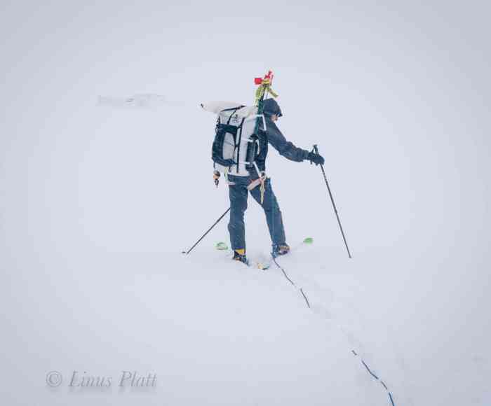
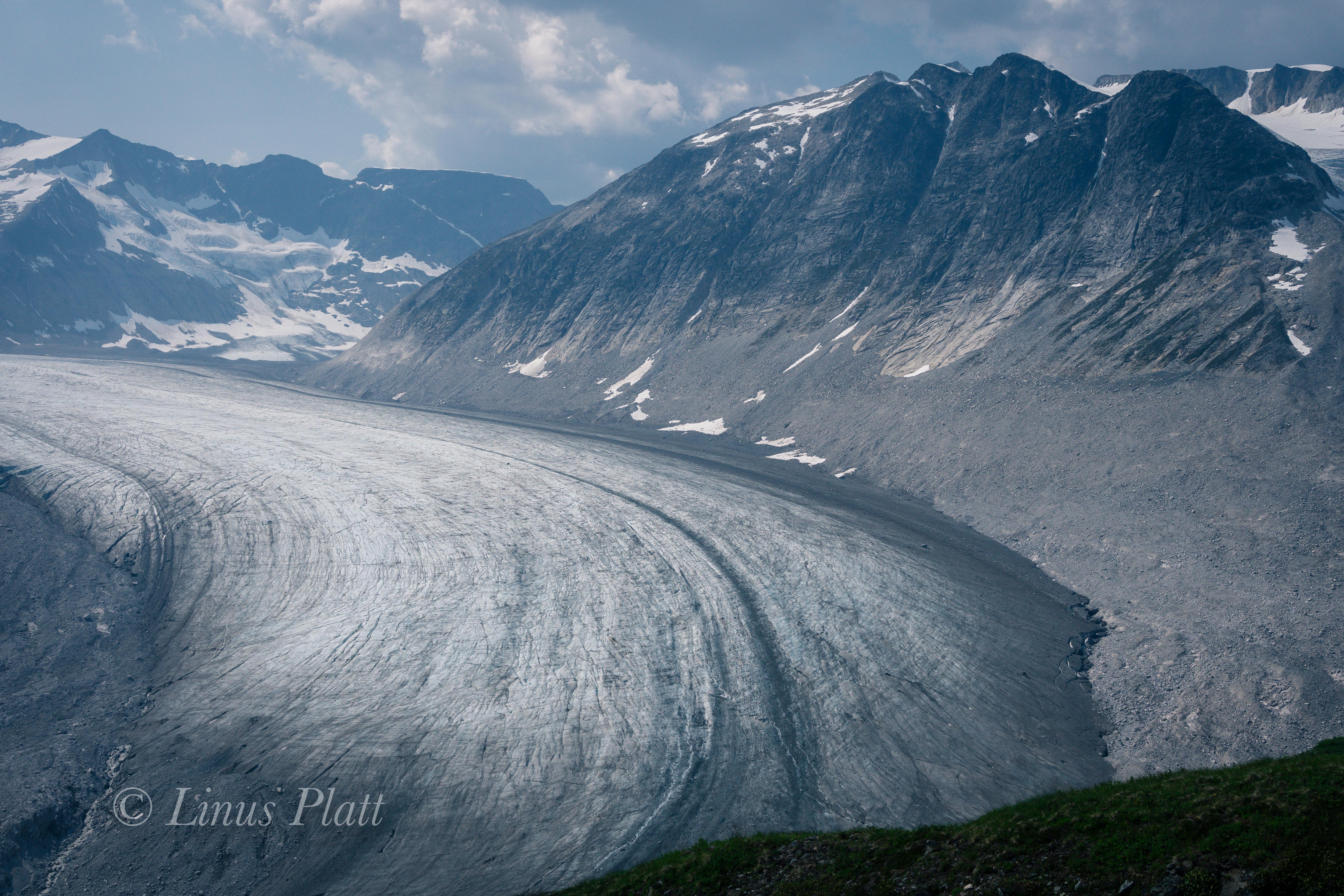
The morning sees bright, sunny, and cold conditions; we shovel tents free from the clutches of last nights dump, and afterwards sit down to fire up stoves for coffee and food. For the first time on the trip, it’s cold enough to warrant my big puffy down parka and puffy pants, of which I am grateful for. Today we will climb above the First Icefall and find a place to dig in a new camp. We pack up nearly all the remaining food, fuel, and wands to move up to the next camp, which having no idea where that might be, we hope to make it somewhere above the icefall at around 9,000 or 10,000. We also pack up tents and bivi gear, essentially leaving Camp I indefinitely. Skiing up the glacier is sensational; the sun is bright and the icefall, visible to this extent is the first of the trip. There is an artistic expression to it that is singularly unique, the seracs are lined up and are poised to do what all seracs must ultimately do: collapse and fall. There are great crevasses that are exposed and hold depths unknown. One serac near the bottom of the puzzle has a giant round hole in it, resembling an arch from the desert southwest. It’s bare blue ice shimmering a color that really only happens on a glacier; to call it blue would be simplified – it is far more complex than that. There are hues and abstracts no human words exist for. A glacier to me is a spiritual representation of life itself… growing from the womb of the mountain, picking up speed and flowing with intensity; crumbling along the way. Power, beauty, destruction, re-birth. It reveals textures and patterns not seen anywhere else on Earth – the smoothness of it’s terminus is somehow what we might all wish for at the time of our own demise…My infatuation with glaciers has been alive within me since I was 14 years old. The sensation they provoke in me is a deep sense of connection to the mountains and the Earth as a whole. I am the glacier. These magnificent rivers of ice are a truly unique entity; they are ancient beings and the environment they provide is as exclusive as its danger. Falling into a crevasse is one of my biggest fears, and the possibility of being deposited into one of these icy tombs commands the utmost respect and precaution. Passing our cache from yesterday, we figure we’ll continue on in search of Camp II, then return later for the stashed food and fuel. We zig zag around some of the bigger blocks and carefully around some open crevasses where the incline of the icefall steepens. Skiing upward gains a bit of altitude and soon we are looking down upon most of the seracs where a diagonal traverse puts us at the base of a great and stable serac at about 8500′ where we decide to dig out tent platforms. There are some disagreements among us about how and where exactly to dig created a minor chaos that we had to work through. During this event, it was decided to simply dig out a basic shelf in the incline, make a cache, and ski back to Camp I for one more night before committing to going higher.

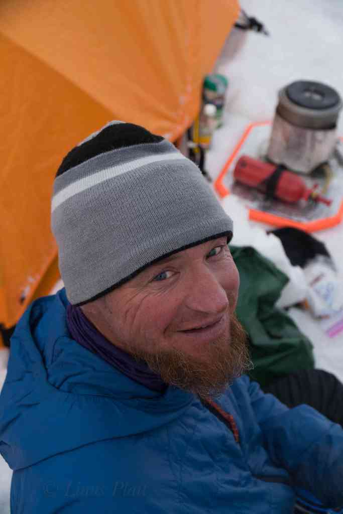
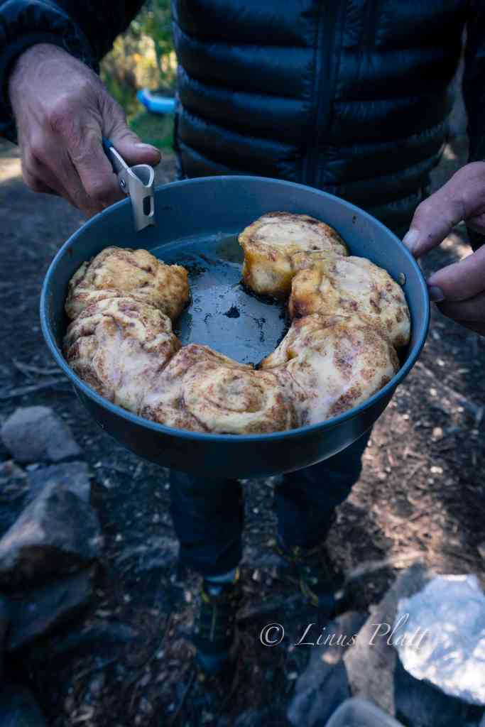
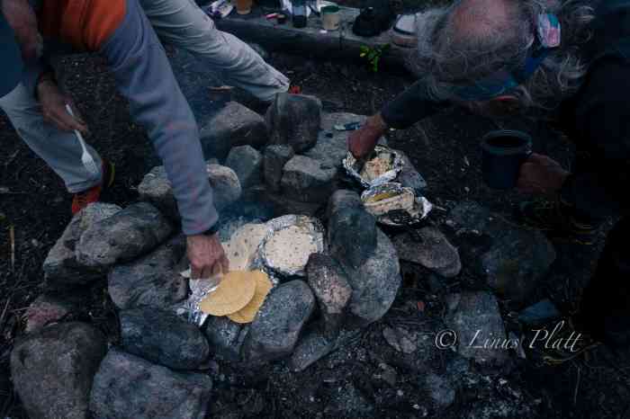
The intense sun on this beautiful day has a negative effect in that the snow conditions are deteriorating rapidly; there is a dreadful breakable crust on top of sugary powder that, had I been skiing in modern alpine touring gear (and was a better skier) would still give me trouble. Skiing down this steep incline in my double boots and Silvretta mountaineering bindings was, at least for me, pretty much impossible. Rich was also having a difficult time of it, and looking back up towards Camp II, I see Cam and Jeff carving long graceful arcs whooping and hollering in joyous outburst. The four of us convene and I decide the best way for me to descend the icefall is to take my skis off and posthole down through the crevasse field. Rich agrees and after removing skis and affixing to our packs we begin the descent as Cam and Jeff pass us with lightning speed and are soon at the base of the First Icefall, where they remove packs and wait for Rich and I. We descend slowly and carefully, roped up and employing safety measures for crevasse danger. We no longer have the safety net of having our weight spread out with skis on our feet, instead we take each step with care into the breakable crust, penetrating 18 inches or so till boots hit solid snow. There is no need for crampons at this point as the snow is soft with the intense, glaring sunlight. One foot in front of the other, gently as she goes. Suddenly, my left foot punches through into black space and my body drops. The butt end of my pack hits the snow and I stop; my leg dangling in space. I yell out “falling!” a little late in the game, but I turn to see Rich already dug in ready to catch a crevasse fall. I easily extract myself from the hole; I peer into the black hole of the crevasse to see exactly nothing but menacing darkness. We continue on, more gingerly this time until we reach Jeff and Cam basking in the sunlight. They were unaware of the crevasse incident, and after a brief rest, Rich and I don skis and we all ski the gentle slopes back to Camp I, where in classic fashion, Rich fires up the stove and cranks out a batch of cinnamon rolls on the stove, aided by Jeff’s “pot parka”, a fireproof fabric cover that fits over the pot on top of the MSR stove that aids in heating and reduces fuel consumption. It also makes for a good make shift oven of sorts, hence cinnamon rolls.

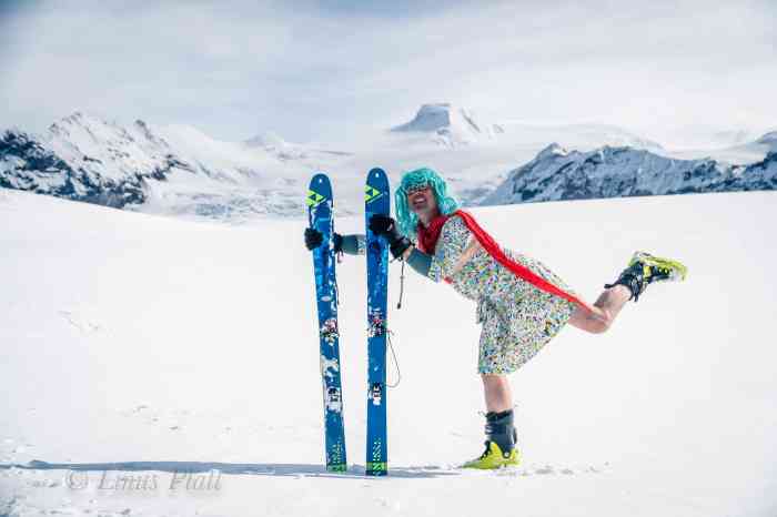
Another night at the snow block camp and in the morning we disassemble everything in its entirety for a second time. This morning we are being extremely casual regarding time, as the weather is decent, and we are all enjoying just hanging around drinking coffee; it should not take us long to make our accomplishments today. Cam is an accomplished writer and has a penchant for sometimes bizarre humor and tends to be pretty successful at making everyone laugh. When I lived in Boulder back in the early 90’s, Cam and Ann would drop by my house for from time to time, often times dressed up in an array of unusual costumes; sometimes he would show up as a drag queen or lumberjack, he always had some kind of shock value humor happening. Today is no exception as he disappears around the back side of the snow blocks, emerging minutes later wearing a multi-colored dress, a bright blue wig, and clutching in his arms his beloved blow up sex doll “Sheila”. We were all laughing pretty hard at the ridiculousness of this scenario up here on the flanks of Mt Sanford, camped in a crevasse field on the Sheep Glacier. Cam and Jeff both had the benefit of being sponsored with skis and boots for the expedition, so we figure we owe the sponsors some photos, and the drag queen/sex doll outfit commanded to be apart.

After the photoshoot, we pack up in a fashion that concludes our stay at Camp I, rope up, and ski upwards toward the icefall. The weather is another fine day, and I can’t help but feeling like we have not been taking advantage of it fully. I feel we should be higher on the mountain by now, but regardless I am happy to be here with my friends as I look north across the great drainages that separate the Alaska Range from The Wrangell Mountains. Far, far off, I can see the peaks of the Central and Eastern Alaska Range: Mt Hayes, Mt Moffit, The White Princess, Mt Gakona, and at the far eastern terminus of the range is the remote and seldom climbed Mt Kimball. This drainage is a unique and beautiful area of Alaska and is home to the headwaters of the Tok, Slana, and Copper rivers. It is an area of incredible white spruce forests, Athabaskan native villages, wildlife, and expansive wilderness and natural history. Far, far off to the northwest, I can just barely make out the faint outline of Denali, The Great One. We ski silently till we near the base of the seracs of the First Icefall; Rich has been moving slowly today and is quiet, something is on his mind. Jeff and Cam were ahead of us and were taking a break as Rich and I skied closer. After all four of us were back together, we took off our skis and had lunch with the bright glacial sun beating down. After some discussion, Rich and I both agreed that the skiing was a bit over our heads given the equipment choices we had made. At the beginning of the trip, Rich and I discussed this before even leaving Anchorage and we came to the conclusion that should the need arise, we could always take skis off and simply crampon up Sanford, but after punching through a crevasse yesterday, removal of the safety net the skis provide was not really acceptable. After a brief GPS weather check and the realization that another storm was developing, Rich stated that he did not wish to continue, and me being his rope partner, I agreed to accompany him back to Camp I while Jeff and Cam opted to continue on to our dugout for Camp II and beyond if possible. So it was decided; We emptied our packs to split up gear and food. Since Rich had one stove and I the other, I hand Jeff the stove and cook pot, while Rich and Cam divided up most of the food we have. After a brief discussion on logistics, Cam and Jeff saddle up and begin the ascent through the icefall, as Rich and I turn and head back to the snow block camp. When we arrive, we realize that the wind barrier was deteriorating from the intense sunlight, and with the impending weather front moving in, we spend the remainder of the afternoon cutting snow blocks and reinforcing the walls of camp. Looking back up the mountain, we spot Cam and Jeff; two tiny figures just reaching the platform of Camp II. Later, we spot a lone figure skiing down from the camp and through the icefall. Not long after, Jeff comes skiing into camp by himself and wanting to know why there was not a lighter in the stove kit. Rich and I informed him that lighters belong in ones personal kit (pocket) and it was his responsibility to have one. For whatever reason, neither Jeff nor Cam had a lighter between them. Baffled by this, I dig through my bag and find my 3 – 4 lighters and hand him one. At first Jeff seemed annoyed by the fact that there wasn’t one with the stove, but by the time he started his ski back, we were all in good spirits once again. I did find it disconcerting however that he was willing to ski 2500 feet down through an ice fall and back by himself and unroped. Skiing down unroped is one thing and is a more or less an accepted practice, but going up at a snails pace is quite another. Regardless, for whatever reason, He and Cam had decided on this and so it was. Rich and I bid Jeff farewell and he began his long arduous ski back to where Cam was holding down camp. That night, Rich and I settle in, preparing ourselves for a stay at Camp I for an undetermined amount of time, as we are hoping that the weather holds and Cam and Jeff will simply make a big push for the summit in a day or two. Later, it begins to snow again and this time is accompanied with intense wind. Our reinforced snow walls are giving great protection, but we imagine that Jeff and Cam at the precarious platform at 8500′ might not be faring as well.

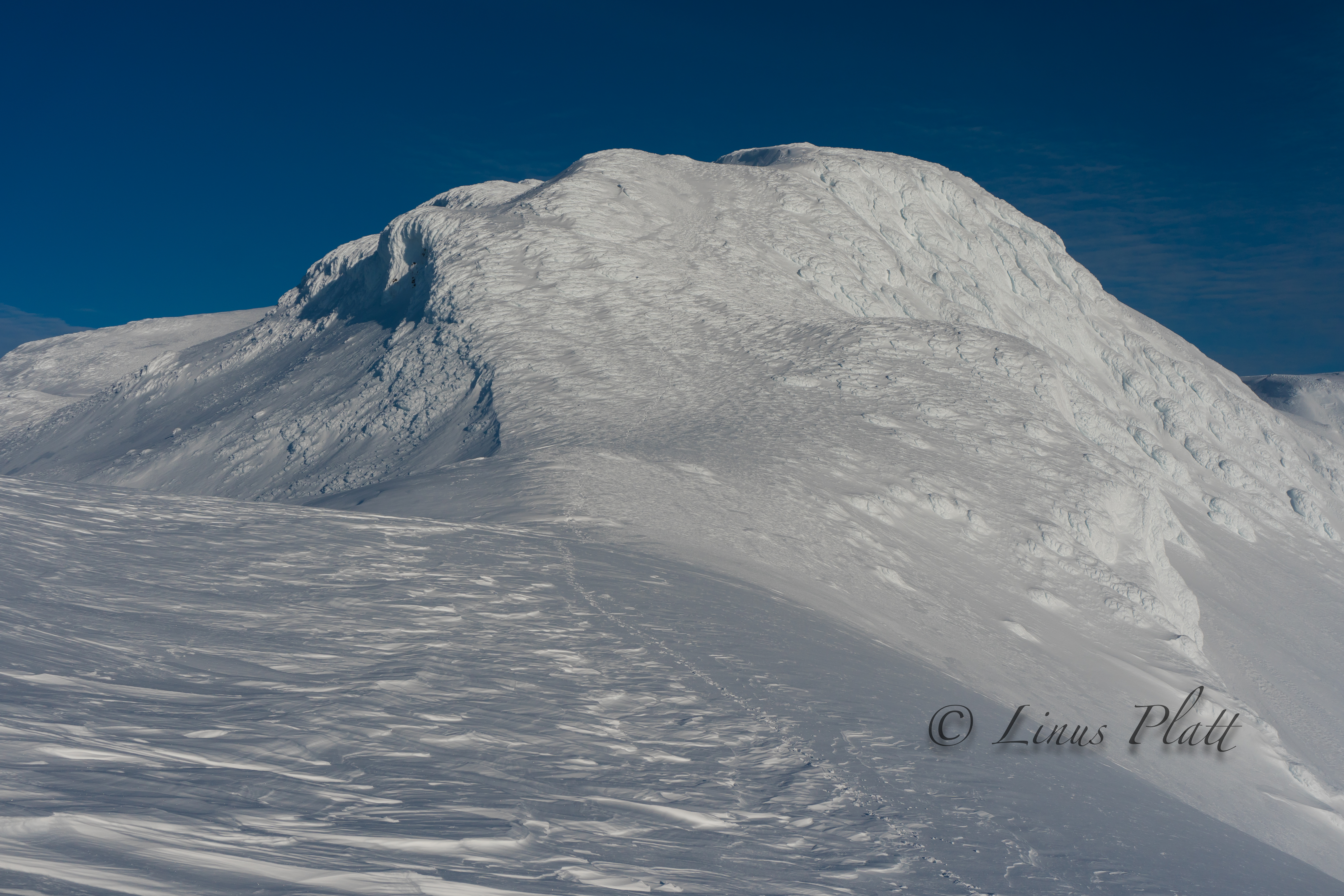
The morning brings sunshine and a calmness that was unexpected, so Rich and I spend most of the day just lounging about soaking up the sun, talking, eating, and sleeping. By late morning, we see Cam and Jeff as two tiny specs advancing beyond the serac camp and are now just below the amazing and unique Nunatak whose summit it at just about 10,000′. For many days I have marveled at this Nunatak and its amazingly smooth ice walls that just beg to be climbed, which is exactly what Paul Tureki and partner did in the 80’s on an expedition that involved a dog team and skiing from Sanford’s summit. Like so many of Alaska’s 26,000 glaciers, the Sheep Glacier has been around for approximately 30,000 years; the Nunatak in question is likely a great and monolithic rock formation jutting from the flanks of the mountain, but thousands of years of glacial ice have all but buried it to the point it is literally a part of the glacier today as we see it. There is no rock exposed, only massive sheets of ice and an overwhelming serac barrier east of its smooth rounded summit. Its west face, the one that Tureki climbed is a steep 800′ slab of beautiful shimmering glacial ice that later in the day exhibits a haunting sheen giving the entire structure an eerie yet alluring quality.

By late afternoon, we can no longer see Jeff and Cam, and all we can do is speculate on their whereabouts and condition. Rich and I will remain here on the glacier to provide Cam and Jeff any support they may need. The barometer indicates another low pressure building, but at the moment the weather remains somewhat decent. The following day, clouds begin moving in, but remains windless and snow free for several hours till late afternoon rolls around and a light but steady snow begins to fall. Not long after, the wind pick up and it’s just like old times, and a laborious session of snow block cutting and stacking sees Rich and I fortifying camp once again in the deepening squall. After finishing the task, Rich cranks up the stove from the vestibule of the tent and we sip on some soup and tea, pondering where and what Cam and Jeff are up to. Sleep eludes me on this evening and as I lay in the tent I feel something is taking hold. Suddenly and with out warning, I am dashing from the tent and running for the latrine hole in the glacier, where I empty my bowels of liquid and stand pant-less staring into the blasting spindrift of the daylight night. I crawl back into the tent and slither back into my sleeping bag, fully aware that something nasty now resides inside of my body. Thankfully, I did not have another episode like that the remainder of the night, but instead I fight off a massive headache, stomach cramps, and an oddly sore throat. This persists well into the next day, and by mid afternoon the weather has improved just enough for me to lay my sleeping bag out in open to observe the upper glacier and Nunatak. Drifting in and out of sleep, Rich hollers that he sees the boys coming down from the area just above the icefall; two tiny figures seen skiing at a brisk pace, descending from the upper reaches and into the bowels of the seracs. Before long, the two of them are clearly visible below the icefall and within 10 minutes ski right into camp, where Rich has hot water waiting for them to re-hydrate and eat.

After a night battling the storm on the tent platform of Camp II , Cam and Jeff had broken camp completely, ditched one of their tents, some food and fuel and made a cache there, deciding on moving fast and light up past the Nunatak where they dig in to the side of a giant serac, setup the tent, and proceeded to take advantage of the temporarily clearing weather by skiing to and from the summit of the Nunatak. That night once again being hit by the increasing storm, it was decided that come morning they would descend back to Rich and I at Camp I.

The four of us back together again, we have a big feast and a hidden stash of whiskey allows a couple shots each. The weather is not great, but we are all having a good time; myself included regardless of my slowly improving stomach illness. The air is mostly still, but a light snow continues to fall and we decide that the best plan of action is to get out in the morning, and we send a GPS message to pilot Jake giving him the heads up. In the morning, the weather is about the same and no one really wants to deal with much; camp is a silent monastery for a long, long time before Rich and Jeff bust out breaking the silence. It is another cold morning wrapped in puffy gear whilst making breakfast, taking down tents, and reorganizing everything in order to do a single carry back to basecamp. By the time we leave, the temperature had risen significantly and the snowing had stopped. We all stand there gazing at the empty ring of snow blocks; each of us with a massive pack on our backs and a fully loaded drag bag behind us. We gingerly ski down glacier; the weight of the packs and the menacing instability of the sleds making the ski descent unnerving, but by the time we got to the tongue, we had worked ourselves into skiing groove and we were all able to carve a few last turns of the trip before descending completely to the now barren talus below.

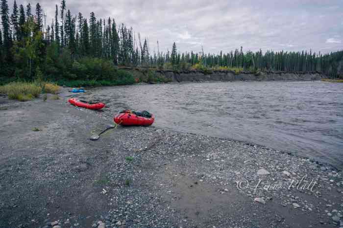
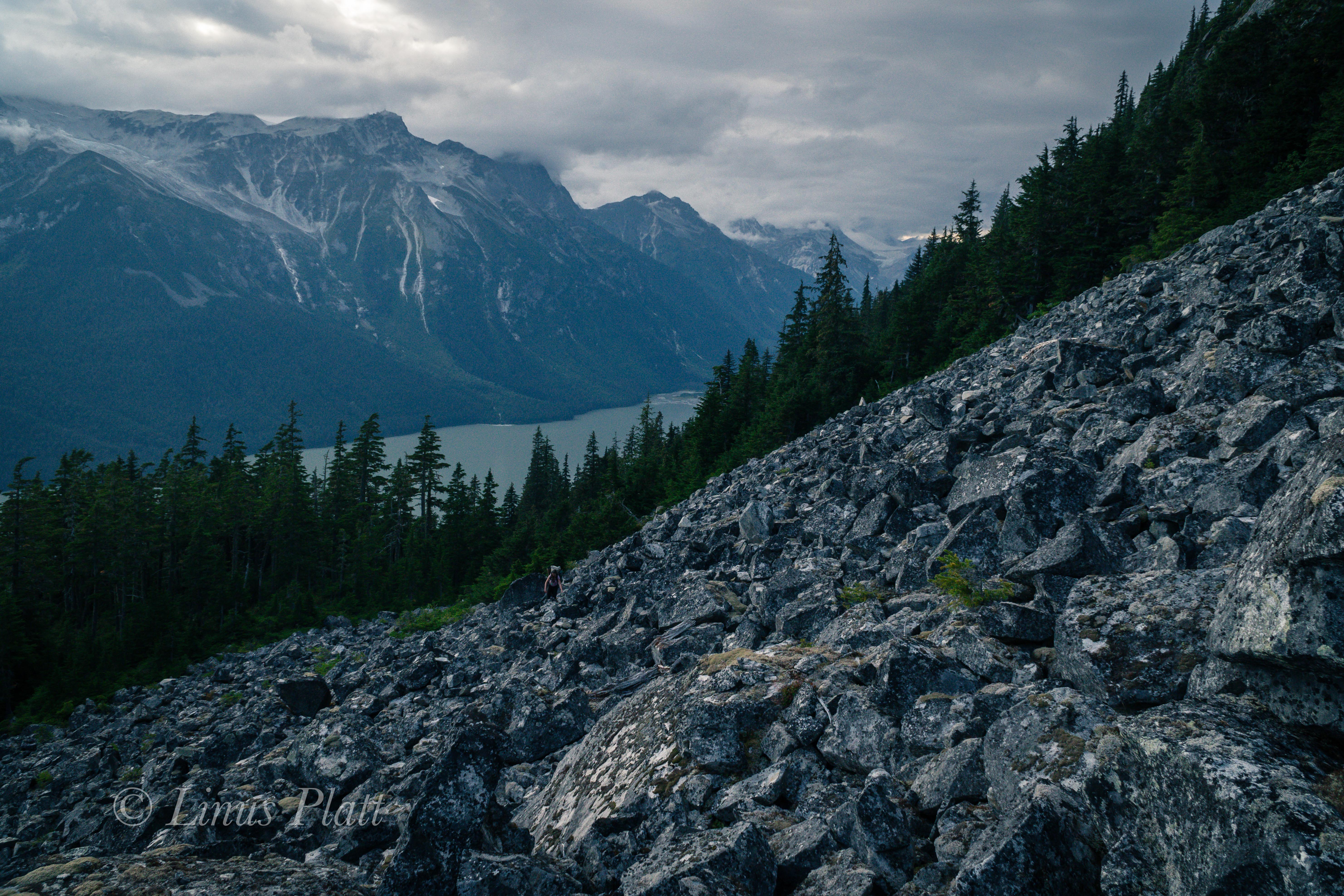
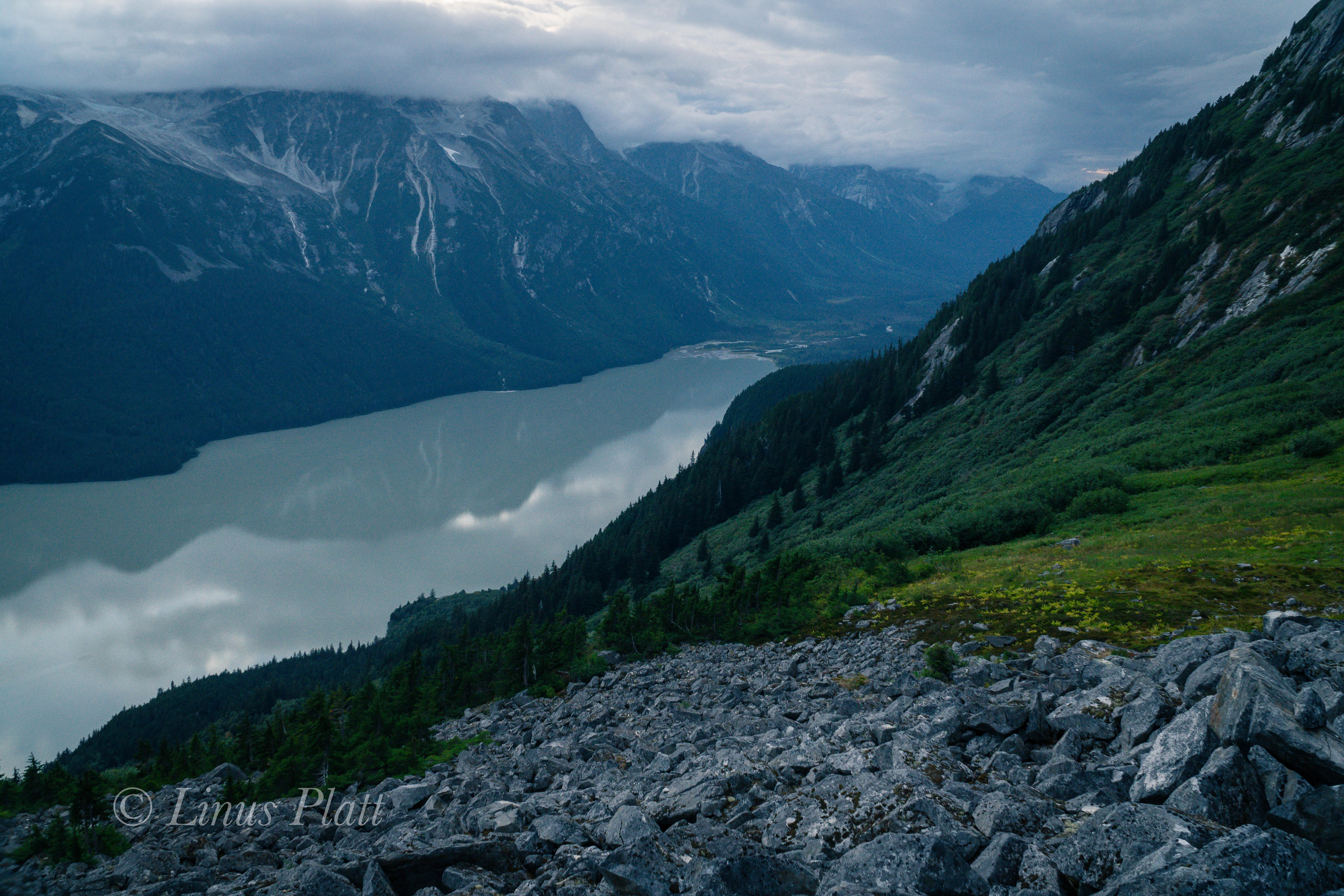
Two weeks prior, there had been enough snow on the pumice scree to both ski and drag our sleds effortlessly. But now, the snow not far beyond the glacier had disappeared, exposing the jagged pumice underneath. We have no choice but to remove skis and walk. We can either make a double carry to basecamp, coming back for the sleds tomorrow, or just drag them through the rocks and get it done. We choose the latter, since our duffle bags are wrapped in cheap plastic tarps giving a decent sliding action even on the pumice and also protecting the more expensive duffle bag material. Eventually we are past the cree and talus and are traveling previously unseen tundra, where a lone Caribou crosses our path; likely a scout for a herd not far off. I am having difficulty with the drag bag, so I decide to ditch it and come back tomorrow for it. Cam, Jeff, and Rich and continue with both pack and sled; the going is very slow, but by late afternoon, we are all back at the landing strip setting up tents and getting organized. Later, a call to Jake confirms that he will attempt to pick us up in the morning, but it’s all up in the air since the weather is deteriorating and it is beginning to snow.

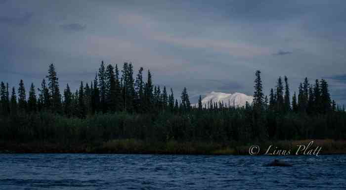
I sleep deeply for 10 or more hours and when I awake I find the ‘Mid sagging in from what looks to be several inches of new snow. I can’t help to feel a bit of dread, since this could prevent Jake from landing, as he has tundra tires fixed to the Super Cub that do not fare well in fresh snow. He was able to land previously because the old snow on the gravel airstrip was packed and settled. But this new snow could be an issue. Regardless, I have a drag bag to go and get up valley about halfway way to the glacier. Luckily it is very early as I crawl out of the shelter and even though there are several inches of fresh powder, the sun is out and it is an outstanding day. It is quite cold in the morning, but by the time I had gotten moving to retrieve my drag bag, the sun felt almost hot. Alone, I stomp up valley in mountaineering double boots across the scree and tundra to my stash, where I fill my empty backpack for hauling back to the airstrip. The pack is monstrously heavy and I can barely get it shouldered, and once I do, vow not to take it off again till I reach camp. Regardless of the weight of the troublesome pack, It feels incredible to be out here hiking across the snowy tundra; it was the first time I had been alone in 15 days and as I turn to look back at Sanford, she bares her true summit for me in the glaring sunlight. Ironically, this was the one and only time I would see the summit on the entire trip. Once back in camp, I drop the pack and a great sigh of relief pours from me. The warmth of the sun is extremely intense, and Rich is busy skiing back and forth, shirtless and in his boxers, up and down the airstrip attempting to get it packed down enough for Jake to land. We all join in and after a bit we are satisfied with the results and another call to Jake is made: he is on his way. By noon, we hear the unmistakeable growl of the Super Cub, and Jake lands the aircraft effortlessly on the packed snow of the runway we had tailored. A man pops out of the plane, it’s not Jake but his pilot Leif, who is filling in for Jake. One by one, Leif ferries us back to Red EagleOnce in the air, I look back to see the tongue of the Sheep Glacier disappearing over the massive moraines below it, and soon we are flying low above the endless tundra and Alaska’s great Boreal Forest.

Stepping out of the plane at Red Eagle, my boots hit the grass of the landing strip and once Jake takes off to retrieve the others, the boots come off and sore feet and toes do the same. It feels sublime to walk on grass and be surrounded by trees rather than snow, ice, and rock; there is a gentle breeze that drifts through the treetops giving way to a faint and pleasant hissing sound that is absent in the higher alpine environment. Once the last gear load is dropped off, we settle finances with Leif and he lifts the Super Cub into the air and heads east towards Tok. The four of us stand there for a moment, unsure of what or how to make a move. We stagger over to the lodge, where Rich and I rent a cabin for the night and Jeff and Cam do the same. After getting the truck and dumping all of our gear, we all take much needed showers and then convene at the truck for a plan. It’s late afternoon, and we all want beer and food, but the nearest tiny store is about 40 miles up the Tok Cutoff. It has to be done so we pile in the truck and blast off for an 80 mile round trip beer run. The little store at Menstasta has the bare provisions of which we make do with and happily drive back to our cabins at Red Eagle. After too many beers and some makeshift supper, we all stagger off to bed; Cam being so drunk, I had to quite literally carry him to his cabin and put him to bed. Sometimes when I am overly exhausted I cannot sleep; it is a strange anomaly and tonight is a template for that theory, and at 3 am I stagger out to my truck and grab tent and sleeping bag. The cabin is just too stuffy and the bed too soft. Once in the tent, I fall into a coma-like state that allows me to sleep till 10 am. We drop by the lodge where Judy asks us to join them for breakfast and we all eagerly accept. It feels fantastic to sit at a table with hot food and coffee and listen to Judy and Richard’s stories about their lives in and around Alaska, their bush piloting to and from Siberia and the tales of them becoming the owners and operators of Red Eagle Lodge.

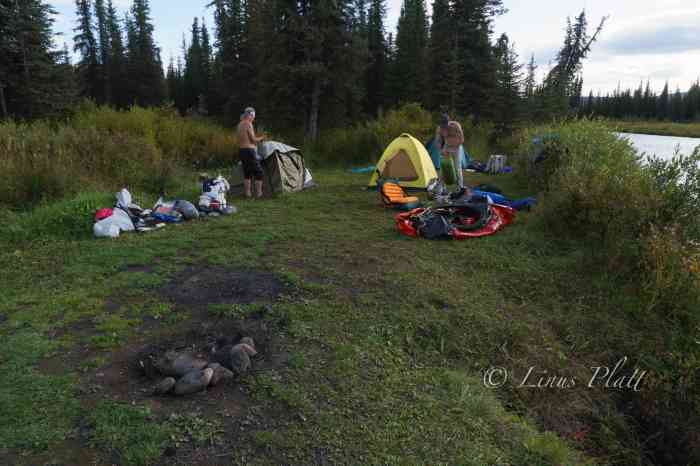
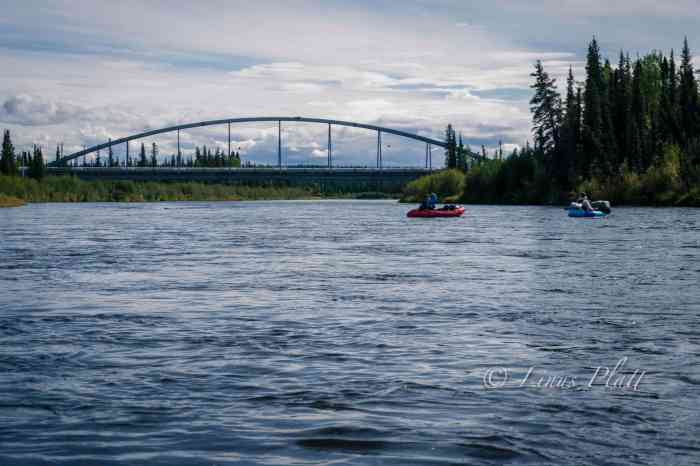
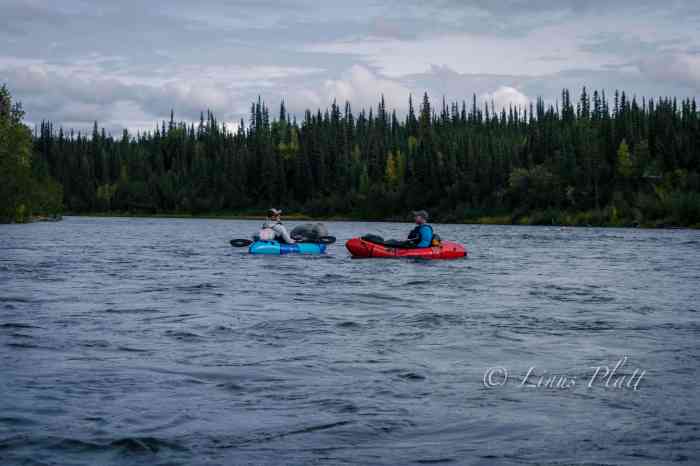
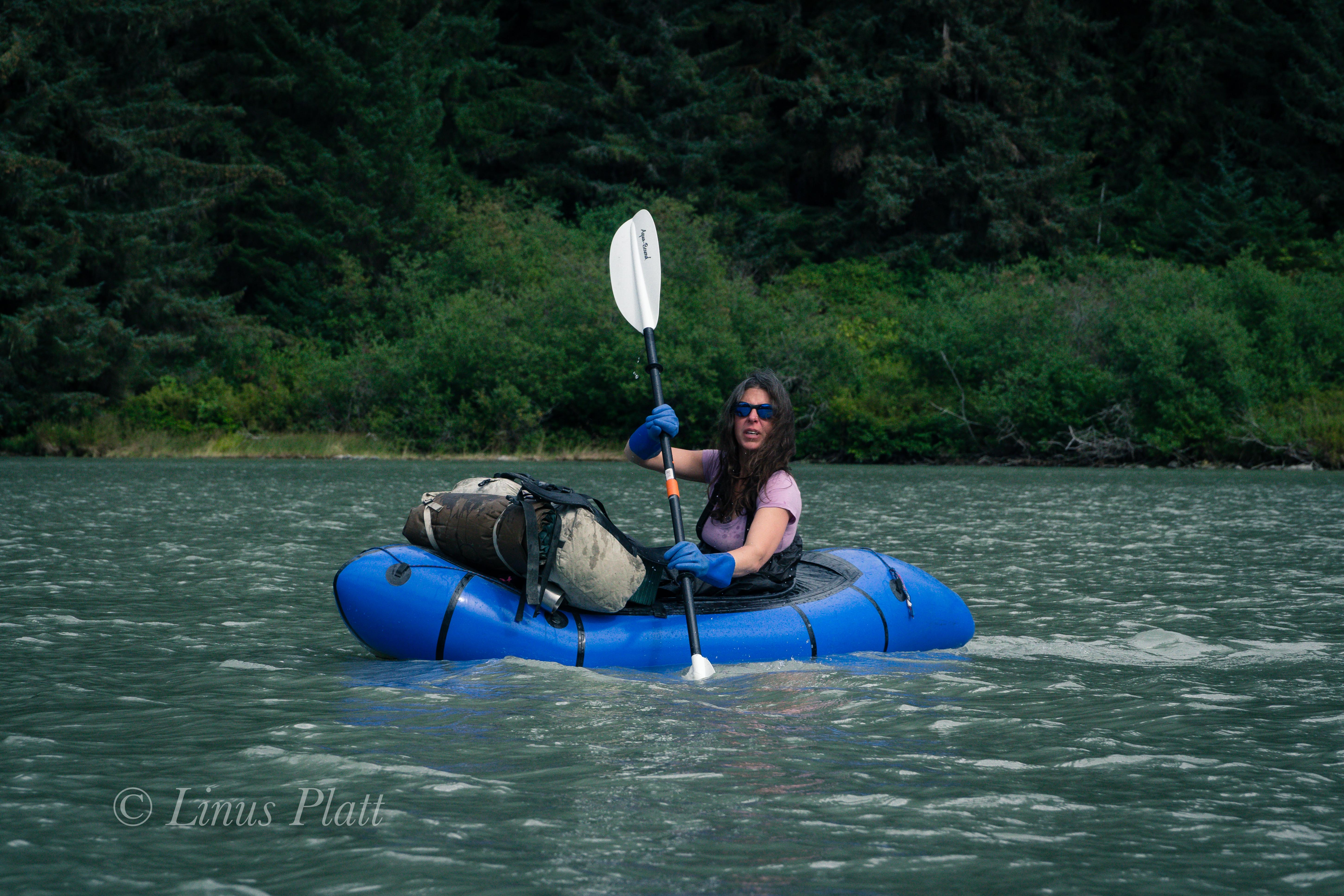
After breakfast and a casual organizing of our entire kit, we decide to head off for some R&R and sightseeing. Two years prior I had ridden my bicycle from Slana to Nebesna along the incredible and wild Nebesna Road; it is the only road access into Wrangell St Elias National park from the north, and features an assortment of mining and natural history, wildlife, stream crossings, great camping and incredible Alaskan scenery. Spending most of the day slowly traveling the road and stopping often to gawk at the incredible views of the East Face of Mt Sanford, we are amazed that the entire mountain is free and clear from any sort of cloud, mist, or storm; the summit is clearly visible. I can’t help but to think what it would have been like for us if we were up there during this weather window. That night a Jack Creek we make a camp and grill burgers, enjoying the outstanding weather and calm. In the morning I break out my packraft and we each do a quick lap on Jack Creek just for giggles. After breaking camp, we drive up the road for a hike to the historic abandoned Rambler Mine, where views out to the massive headwaters of the Nabesna River and Nabesna Glacier snake out of one of Alaska’s most intensely wild regions between the Wrangell Mountains to the south and the Mentasta Mountains to the north. A day later and we in Anchorage, and a trip to the local butcher shop to procure makings for shish kabob, a few beers, and we head off to find the Air B&B we had scored for the night. 24 hours later after dropping off my three team mates at the airport, I find myself once again within the “civilized” circle of the Anchorage and Mat-Su borough, and once again struggle to find a place to camp. I settle on heading up the Knik River to find a semi reasonable albeit makeshift camp on its sandy shores where ATV’s and fisherman are never far off.

With plans to meet Angela to climb the Yukon’s Mt Archibald in a few days, I have a little bit of time to kill, so I hit the road in the early morning and head north up the Richardson Highway towards Delta Junction, where I know of great and wild camp spots and for the first time since leaving Anchorage, I feel at peace and I’m able to properly rest. After a casual day on the Jarvis River eating, napping, and going on short walks, I pack up and drive towards Tok, where passing Yerrick Creek north of town I see that the river is far too low for paddling, so I continue down the Alaska Highway where cresting a hill in a remote area of Eastern Alaska, I pause briefly to gaze at the far, far away silhouette of of Mt Sanford, her cloak of thick glacial ice shimmering phosphorescent hues of purple and red penetrating the high altitude sub arctic air, and at that moment in time, I feel my intense and deep connection to this amazing place and the knowing that nothing can ever take that away.

RAVENS ON THE GULKANA

By Linus Lawrence Platt


It had been over two years since the Over The Hill Expeditions gang had gotten together to hit the hills so to speak; in 2019 it was an attempt to climb and ski Mt Sanford (16,237′) the second highest peak in the Wrangell Mountains of South Central Alaska with Rich Page, Jeff Rogers, and Cameron Burns. It was trip filled with good times, friendship, and adventure regardless of our not reaching the summit. After the Sanford expedition, Rich and I conjured up a trip idea for an attempt on the East Ridge of Mt Hayes to take place the following spring, but the plandemic took shape, I lost my job, and the notion to climb Hayes pretty much went up in smoke. Disgusted with too many things about Haines, I built a custom tiny home/camper (dubbed The Raven), sold my house, and hit the road for Fairbanks to re-locate. It was later in the spring that the plan to do a packrafting trip of some sort in the summer or fall of 2021 was born.

Rich, a former Denali guide from Colorado, managed to free himself from his business, Savage Gear, in North Conway, New Hampshire, of building packs and repairing outdoor gear and bought a plane ticket to Fairbanks for the end of August. Thinking a third person would be fun, I invited my friend Chris Gavin from Baltimore to join us on an adventure. Chris and I had first met in Fairbanks in 2017, and we had remained in contact ever since. We had often discussed doing some type of backcountry trip together, and when the notion of the Hayes trip was born, Chris agreed to be a team member, but of course that expedition never saw the light of day. For 2021, Rich and I mused over several possibilities, initially considering something in the Brooks Range, but the time frame for this trip dictated something further south, and we finally settle on paddling the Gulkana River from its source near Paxson Lake in the Alaska Range all the way to its terminus at the Copper River at the foot of the Wrangell Mountains in South Central Alaska. The Gulkana River is a beautiful Class II-IV river that flows through the dense boreal forests of Central Eastern Alaska, ancestral home to the Athabascans, and a major tributary to the world famous Copper River.

After losing my job in March 2020, I spent an entire year building The Raven, remodeling the house for re-sale, and modifying and repairing both vehicles for my departure in April 2021. It was an exhausting period with little time for much else. For me, leaving Haines and relocating to the interior was no simple task; I had two trucks, a home built truck cabin, and a cargo trailer that held my carpentry tools and the bulk of my belongings. It took the last year in Haines selling, giving away, and throwing out material possessions to make this happen. In a time when most Americans are busy collecting things and spreading out, I am quite content, ecstatic in fact, to be reducing my world load and becoming as compact and efficient as possible. Even still, not one, but two trips had to be made to Fairbanks. The first would be in the Toyota truck pulling the cargo trailer and stashing both at my good friend Tony’s place in Fairbanks, then flying back to Juneau, taking the ferry back up to Haines, and repeating the process; the second time armed with the Ford F250 and The Raven, my custom made truck cabin built with Alaskan winters in mind. Of course, with Canada closing its borders to “non-essential” travel (all travel is essential, for one reason or another) this made for a tricky escape out of Southeast Alaska. Luckily, my buddy Sven wrote me up a semi-fake employment agreement, and by the skin of my teeth, I made it across the Canadian border 40 miles from Haines. When I finally got back across the Alaskan border and arrived in Tok, I literally got out of the truck and kissed the ground. Back in the Real Alaska… After arriving in Fairbanks, I got a post office box, changed my driver’s license, car insurance address, and vehicle registration. And just like that, I was now a resident of Fairbanks, ensuring the Canadian Border Robots would give me a pass on the 2nd trip. My primary concern after the fact is that they would remember me from the week prior (I have a very unique and somewhat memorable name) Alas, it was a non-issue and and before I knew it, The Raven and I were camped along the Gerstle River near the Alaska Range in one of my favorite parts of the state. All said and done the escape from Haines was literally the single most difficult task yet in my lifetime. Not long after, Angela boards a ferry with her truck bound for Whittier, and makes the drive to Fairbanks. She too had felt the need for something different than what Haines has to offer.

Haines, Alaska… well sort of Alaska; it feels a bit more like a Canadian province than a de facto Alaskan town, is a beautiful place indeed, but contrary to the arrogance of its locals, Haines does not in fact have the monopoly on “Alaskan Beauty”. In fact the Central Interior with its majestic mountains, enormous glaciers, rivers, forests, and expansive valleys are far more appealing to this soul. As are the people and the weather; I found Haines, and by a margin, the people (especially the outdoor adventure community) of Haines to be somewhat cavalier and impudent. Obviously this does not apply to everyone; there are a number of Haines-folk whom I hold in high regard and have the deepest respect for (you know who you are). The winters are heinous for the most part, where it will snow, then rain on top of snow, then freeze, then turn to ice, then repeat… all winter. I’ll take minus 20 degrees F in the semi-dry subarctic climate of the central interior over the plus 30 degrees F and 90 percent humidity of Haines any day of the week. After nearly 8 years living in Haines, I’d had enough. So back to from which I came was in order (I’d lived in Fairbanks for a stint prior to taking up in Haines).

The entire spring and summer was filled with many, many work and carpentry projects for my good friend Sven at his Hostel, converting an old cabin into a genuine public espresso shop, getting my own scene together on my friend Tony’s land at a place I now dub The Raven’s Roost, cutting firewood for the impending winter, and countless other activities regarding work and life preparation. In between all of this, I still managed a day trip to the Alaska Range, a three day fly-in trip to the Brooks Range, a two day pack rafting trip on the upper Chatanika River with Sven, another 2 day driving trip to the Brooks, and several other hikes and forays into the fantastically beautiful White Mountains just outside of Fairbanks. The Raven’s Roost is a good place to throw down for an undetermined amount of time; it sits on several acres of boreal forest, is mostly quiet and private, is close to town (3-5 miles), and on appropriate days, just down the hill from my place, one can see all the high peaks of the Central Alaska Range dominating the skyline.

By the time late August rolled around, I was deeply ready for a needed break; I had only paddled once all summer, and it was a good one. Sven and I paddled a great two-day trip down the upper Chatanika, a beautiful class II paddle on the edge of the White Mountains where we paddled for almost 11 hours straight the first day, finally landing on a good camping beach where we roasted sausages on an open fire, sipped whiskey, and had some laughs.

On August 26th Chris Gavin flies in and having a few hours to kill, we step out for Thai food at the consistently great Lemongrass Restaurant, followed by a tour of my Raven tiny home. Once Rich arrives a few hours later, it’s game on to get organized and gear together at Sven’s hostel. The next couple days are spent roaming town in search of this and that, generally followed by a steak or Sockeye Salmon BBQ from when Sven and I had dip-netted in Chitina weeks before.

August had been a typical rain-fest, and honestly the weather was downright miserable (this IS Alaska after all) in the days before we headed out for the drive down the Richardson Highway toward Paxson Lake, but as luck would have it, the clouds part the morning we start driving and one might even consider it a beautiful day. With Chris and Rich driving my Toyota pickup, and me in the lead driving my big Ford diesel, we caravan south through arguably my favorite part of the state. It is here that the Richardson passes through the Central/Eastern Alaska Range and has been the scene of many mountaineering and hiking adventures over the years. Our destination and put in is Paxson Lake, just south of Isabel Pass on the Richardson Highway about three hours south of Fairbanks.

Paxson Lake is fairly large glacially fed lake in Alaska’s interior that is about 12 miles long by about 4 miles wide, and is home to Lake Trout, Dolly Varden, Northern Pike, Burbot, two species of Whitefish, Arctic Grayling, and hoards of spawning Sockeye Salmon from June through September. There is also a King Salmon run in June. The BLM operates a campground and a boat ramp on the east side of the lake, so we opted to spend the night here and get ready for the several mile flat lake paddling tomorrow. The Gulkana River begins its life born from Summit Lake a few miles to the north, where it runs very thin down a treacherous class IV canyon before entering Paxson Lake, where it drains at the Lake’s southern end.

Late that night, from a deep slumber within my tent, I hear Chris outside trying to wake us as the Aurora Borealis is out and wildly going off. I dress quickly and scamper out; the sky is ablaze with one of the true gifts from the north. Chris and I decide to take a walk to the lake shore to catch the show, and seeing the brilliance dancing above the peaks of the Central and Eastern Alaska Range reminded me of why I live in such a beautiful, challenging, and sometimes inhospitable place. Alaska is a genuine treasure 12 months out of the year, and calling its interior my home is something I am extremely happy about and proud of. After the show fizzles down, we walk back to camp and hit the rack.

The morning of September 1st, Chris and I do our truck shuttle to Sourdough Camp further south down the Richardson Highway; luckily we have two trucks so this is an easy operation, save for one minor detail. When Sven and I had gone to Chitina to dip net for Sockeye weeks earlier, there was and still is a major road re-construction of the Richardson, with multiple delays along a 20 mile stretch. I had completely forgotten about this fact when Chris and I rallied south, but ultimately it only added about an hour to the task.

Back at Paxson, Rich has everything laid out and we pack the boats, inflate, and hit the water.
It feels good to paddle and luck is on our side with no headwind. After a couple of hours on the lake, we reach the beginning of the Gulkana where hundreds of Sockeye are spotted in the depths beneath our rafts. This clearly a spawning bed, with as many dead fish as alive. We pull off to a bear trampled area and have a welcomed lunch.

The next section is the real beginning of the Gulkana proper with long, fast and fun sections of class II waves and rollers. After a spell, an old trappers cabin from the late 19th century gold rush era appears and adorning a nice flat and grassy camp spot. We pull off and settle in for the night. The weather is now certifiably glorious and watching the sun set behind the Taiga sees me happily drifting to sleep. Later in the evening, a Cow Moose and Calf zip right past my tent and fjord the river. More Alaska wonderment that makes everything seem all the more special.

The morning brings ethereal mist and mesmerizing light over the enchanted Alaska landscape, and later in the morning we see more Moose both in the river and in the woods on shore. The critters are out and about. This next section is fairly slow and twisty as the river makes its way through the thick taiga of the upper Copper River Basin; an immense area that once held the enormous prehistoric Lake Atna that formed during the Wisconsin Glaciation period more than 40,000 years ago. The lake was formed when what is now the Childs Glacier grew and subsequently dammed what is now the Copper River. After the glaciation period ended, the glacier receded, draining the lake. The Lake Atna basin is fairly flat and covered in Boreal forest with several remnant lakes remaining, one of the largest of these being Lake Louise, a popular fishing and camping destination for Alaskans during both summer and winter. Later, a few splashy sections follow here and there just to make sure one is paying attention, which we must do in order to spot the take out for the upcoming Gulkana Canyon portage. I had been eager to get to this place in order to scout the Gulkana’s biggest rapids in hopes of running them, but after close inspection, I decide that it is better to portage and live to paddle another day. These class III/IV boilers and pour offs looked dangerous to me, and being at least 40 trail-less miles from the highway means be fucking careful.

This section of the river at the canyon was a special place for sure; the roar of the rapids, the granite walls and boulders, the Bear trails, fishing holes, and great camping spots impose upon us the idea of doing no paddling at all the following day and instead do some hiking, fishing, and relaxing.

A nice late sleep in the morning followed by a lengthy round of coffee finds us wandering Bear trails up river to have a good hard look at the Class III/IV chaos in the main canyon. The roar is deafening in spots and there are good side trails leading to the waters edge for close inspection of the drops and hydraulics. I had it in my mind that I might reconsider running the canyon rapids today. One very noticeably absent feature of this canyon is any trace of a real eddy line. On the contrary, there is a significant undercut that looks difficult to avoid. I stick to my decision not to run it, and Chris, who also had notions of running it today, decided to duck out as well in the interest of group safety being this far out from rescue or medical attention. Rich did bring along his Garmin InReach GPS communicator for emergencies, but regardless, pushing the envelope seemed a bit reckless to me. It might have been different if I had been paddling a ton all summer, but sadly this was simply not the case. Upon returning to camp, Rich surprises us by whipping up a batch of Cinnamon rolls on the MSR stove, complete with sweet frosting and hot coffee. We sit with our treats and listen to the roar of the river and I watch as a pair of mated Ravens chase one another through the treetops, each one changing the conversation between them frequently with yet another sequence from their extended vocabulary. The Ravens always have a special place in this world to my thinking and Ravens on the Gulkana that much more so.

A bit later, Chris and I decide to hike up to Canyon Lake, for which there is actually a trail, which in most parts of the Alaska backcountry is pretty much unheard of. The “trail” as it turns out is a muddy, rutted Moose path complete with anticipated bushwhacking. We reach the tiny little lake and being somewhat underwhelmed by it’s size and presence, we turn back and head back to camp. Later, we glance at the map, and Canyon Lake is a much, much bigger body of water no more than 5 minutes further past the pond we visited. Ah well…

Next, we decide to partake in an effort to catch some fish for an anticipated fish taco feast later in the evening. Chris and I grab rod and reel and head downstream to a hole we had spotted earlier on our hike. The very first cast I nab a 17″ Rainbow Trout, and over the course of about 10 minutes, had another smaller Rainbow, and two nice Graylings. All caught using spinning gear with a small sized spoon. Four fish is plenty to feed the three of us for supper I reckon. After cleaning the fish, I build up an existing campfire ring with more river rocks to create a nice oven-like enclosure. Next, a trip up the hillside to a stash of firewood I had spotted earlier, and we were ready. I crank up the fire, wrap the fish in aluminum foil, sprinkle with olive oil and salt, and crack open the bottle of whiskey for a round of shots between us as we feed the fire and wait for the ensuing coals to develop. Soon we are munching delicious fish tacos and feeling quite content. Later, Rich, in his usual Denali mountain guide style, puts together a grand cheesecake adorned with fresh blueberries picked on site, and serves it up adorning his fake hillbilly halloween teeth set. A good laugh was had by all and as darkness set upon us, we hit the sack. At 2 am I hear Chris outside rummaging around and rapping about the explosion in the sky. I’m out of the tent in a flash and setting up camera and gawking at the miracle above. The Aurora was out and taunting us again, this time spread across the sky in a dazzling display of brilliance and color from horizon to horizon.

In the early morning hours, I wake to the pitter patter of a steady rain on the tent, shrug it off, and roll back asleep. At 9 am, still in the tent, the rain seems to be letting up, but the silence in camp is tell tale; no one in camp is eager to get up and pack things up wet. As many hundreds of nights I’ve spent in the wilderness and packing it in wet, the task eventually becomes routine, yet is never enjoyable no matter the level of efficiency. After a damp round of coffee and breakfast, we pack it in and hit the water. The rain has all but stopped, but there is a chill in the air that has mostly been absent so far on this journey. For the first time, I’m wearing gloves and beanie, and under my drysuit are layered clothing. The river is outstanding today… loads and loads of twisty rapids, beautiful scenery, and the ever present sensation of being deep into an Alaska back country adventure.

In looking for a camp spot on rivers, I like the sort of gravel beach that meets certain criteria; the size of the gravel need be small, not too many fist sized rocks, but a good mix of gravel, a little sand, and possibly a few larger rocks for a wind break if a fire is desired, and I always look for stashes of driftwood to make said fire. Additionally, I look for ones that are elevated a bit from river level… not much, perhaps only a foot or two to keep a potentially fluctuating water level at bay. Of course it must also afford flat areas for pitching tents and such. Luckily, the Gulkana is graced with many of these aforementioned bivouacs. On this day, it seemed we had been paddling for a very long time; it wasn’t any longer than the other days, but we were all feeling a bit exhausted and felt accordingly, so when an ideal camp appears meeting the above requirements, we pull off, set up tents, and build a nice fire, mostly just for the psychological comfort a camp fire can provide. The nearby river line is dotted with extremely large King Salmon skeletons and skulls, remnants from the run many weeks earlier. A Grizzly Bear track or two lets us know we share this beach with others. The sun sets and a brilliant display of color paints the sky over a vast section of taiga adjacent to our camp as I crawl into my nylon cocoon and sleep like the dead.

The next day, we anticipate making it to Sourdough where the truck is, and within a few hours, it comes around, and after deflating packrafts and peeling off drysuits, we pack the truck loosely, pile in, and head to Glennallen about 35 miles down the Richardson. After picking up dinner supplies, diesel fuel, and beer, we drive back north to Sourdough and setup a fine truck camp and have a feast of New York Strip, baked potatoes, and a much welcomed salad. Anything but the usual backcountry food and freeze dried meals we normally carry was a treat to the tastebuds and body.

After breakfast and coffee, we decide to keep paddling to at least the Gulkana River bridge near the native village of Gulkana, where the Richardson Highway passes over the river. Many of the accounts we had read spoke only of the section of river north of Sourdough, as the BLM designates that section as “wild and scenic”, which is really nonsense, since the entire river certainly meets that description. To our absolute delight, the section of river south of the “scenic and wild” designation, and the section that few people paddle, turns out to be possibly the best section of the entire 85 miles of river. The river at this point is twisty, fast flowing, and full of many, many class II/III splashy sections. Furthermore, the beauty of this portion is really outstanding, with countless 300 foot high cut banks displaying the colorful geology of the area. Additionally, the fall colors are mesmerizing. Mother nature has painted the landscape all measures of gold and orange hues. The river is big here as well, with hidden boulders and pour offs difficult to see from upriver, commanding one pay close attention. Another long day ends at a good beach camp with a striking view of Mt Drum (12,010′) gracing the horizon.

The following day, we arrive at the Gulkana Bridge, where we ponder the options of either stopping here and hitching to the truck, or continue on to the Copper River and paddle down it a day or so to the community of Copperville. For whatever reason, there was some tension developing between us, and after some poorly concocted discussion, we decide to keep going, which pleased me as I really want to paddle the Gulkana in its entirety. After a couple hours, I see the big, open drainage containing the mighty Copper River, and soon the Gulkana’s crystal clear water slices into the glacial silt of the Copper, creating an often seen phenomena in Alaska when two rivers of different origins merge. Both the Copper and the Gulkana are born of the ice, so it might make one wonder why the Gulkana is clear and the Copper is silty, and as far as my thinking takes me, it is because the Gulkana passes through Paxson Lake near it’s headwaters where the glacial silt is filtered, where as the Copper is a wild and raging specimen shooting directly from glacier to sea.

The Copper River is a beast of a river, born straight from the monolithic mass of Mt Sanford, and known for its treachery, volume, and history, both modern and ancient. It is also known for being festooned with one of the worlds largest Sockeye Salmon runs, As soon as I hit the main Copper channel, everything feels like it went up a notch or three. I suddenly feel intimidated as the sheer size and volume of this mighty river is a whole different experience compared to the little Gulkana. Several days earlier, at a Bear print covered beach where we ate lunch, I managed to paddle off, leaving my PFD behind, and it wasn’t noticed for at least an hour downstream. Now here, on the Copper River, without a PFD, and Rich’s rental packraft, an old school Alpacka boat with a leaky spray deck taking on water, we pull off onto an island in the middle of the river to contemplate the situation.

The main channel we must take looks a tad uncivilized for both Rich and I with our said equipment disabilities. Chris was the only one in the group currently equipment-rich, but we all decide to ponder the possibility of escape. The issue is the main channel that separates us from the highway side of the river. The water is fast and cold. I am suddenly thrown into a psychological battle with myself as a similar scenario last summer on the Klehini River with Angela arises in my thoughts. We decide that the best way is to start a Hairy Ferry (paddling upstream in order to make a crossing) at the most upstream point on the island. Chris goes first, with Rich and I downstream with throw lines in hand ready for a rescue if needed. I see Chris paddle as hard as he can, fighting the current in an attempt to keep the boat pointed upstream. If the not done correctly, the bow will catch the current and turn downstream. If that happens, our plan will fail, and a commitment to the raging channel will ensue, putting us in a much more dire situation. Chris makes the next island, where he pulls boat up on gravel and pulls out throw bag for the next participant, which is me. I paddle like my life depends on it (it does) as adrenaline carries me to the second island. Once again, Chris and I are in rescue mode as Rich makes the third crossing. Since we are on yet another island, we must duplicate these maneuvers one more time, this time matters most as wave train in the main channel could grab us if we are not extremely careful. After another adrenaline fueled crossing, we are on the western bank of the Copper River, and an unknown number of miles from the highway. Had we continued down river to Copperville, we would have been all set to simply hitch hike to the truck at Sourdough, but here, we are at the confluence of the Gulkana and Copper Rivers essentially in the wilderness, unwilling to paddle further, with an unknown and trail-less escape to the highway, which we have no idea it’s distance.

We shortline the boats up a sizable embankment utilizing our rescue ropes and find a pretty nice flat section overlooking the river in which to make a camp. We are all in good spirits since the escape incident went without harm or injury, and we polish off the last of the whiskey, eat a quiet supper and get some sleep. In the wee hours of the morning, it rains solidly, and thus, coercing the three of us to sleep late as per normal during the wet spells. After packing up everything into packs, we shoulder the monster loads, and follow a faint Bear trail north, where we turn west when a drainage appears. Soon we are soaked to the bone from bushwhacking in the wet taiga, but soon it appears we are on track and heading due west toward the Richardson Highway. After an hour or so, I hear trucks on the highway, and without further adieu, we stand on the shoulder of the pavement, feeling pretty ragged and worn. I toss down my bloated pack and begin to stomp north with my thumb out as Rich and Chris guard our packs.

After two separate rides, the first being a couple of Native folks from Gakona, and the second, a Native man from Slana, I’m at Sourdough and walk the quarter mile to the truck. Soon I’m back with Rich and Chris, where we decide to drive to Glennallen for supplies and afterward make the drive back north to Paxson Lake where the other truck is. The next morning a nice
late start sees us happily entering the Denali Highway, 135 miles of glorious dirt road traversing the Central Alaska Range. It had been a few years since I had been out here and was shocked at the sheer number of hunters. Dozens upon dozens of hunting towns of RV’s and 4-wheelers are scattered about the landscape, making it clear there are literally thousands of people out here for the Caribou hunt.

Over a decade ago I rode my bicycle to Alaska starting in my home of 21 years in Moab, and after 3800 miles of pedaling, I found myself on the Denali Highway on a hilltop camp over looking the giants of Mt Hayes and Mt Deborah, the Clearwater Mountains, and the headwaters of the mighty Susitna River. It was at this exact hilltop camp, found by pushing my bicycle up old ATV and game trails, that I fell in love with Alaska and it was at that very moment I vowed to make it my home forever. It was mesmerizing to see this exact place again years later and even more so with the fall colors of the Willow, Blueberry, and Tundra on fire… I named this place Revelation Hill and without a doubt in every way it changed my life forever.

That nigh, camped at Brushkana Creek near the western end of the road, we witnessed yet another spectacular showing of the Northern Lights. Time after time, it never fails to remind me of what a gift the far north is to me. Late that afternoon, we roll back into Fairbanks, where I drop off Chris and Rich at Sven’s and I head home to The Raven to sleep in my own bed for the first time in 12 days. In all, we paddled over 85 miles and spent 8 days on the river including the rest day at the Gulkana Canyon.

A couple days later, the three of us embark the final paddling adventure of the season and hit the Upper Chatanika and repeat the trip Sven and I had had done back in June. Once again, the fall colors are off the hook, and the water levels are surprisingly high, making for an outstanding paddle. That said, the night time temps are dropping and I can feel Old Man Winter poking his head in the door. A couple days later, Rich and Chris board airplanes bound for home and I head home to Raven’s Roost, a hot cup of tea, and a ponder of the coming winter.

Upper Lynn Canal Panorama

Upper Lynn Canal featuring the tiny town of Haines, Alaska below. Panorama taken from just below Mt Ripinski’s summit utilizing 4 separate 6K RAW images from Sony a6300 with 16-50mm kit lens stitched together in Adobe LR…


Chilkat Peninsula Panorama

Social Distancing – Mt Ripinski Style


It’s springtime in Haines and it’s also the time of year I start getting the itch to get out of dodge and head for the hills on some overnight ski or snowshoe trips. Since the COVID madness began in earnest here recently, and the border now closed, homebase destinations are now in order.

Since being laid off from my job, countless house and other projects have taken precedence. A spell of clear and gorgeous weather inspires me to take a break from chores and do an overnight stomp up Mt Ripinski… one of our local summits.

The trail leaving the Young Road trailhead was easy to follow until it spurs with the Ridge trail, where many folks this time of year simply double back towards town via the Piedad Trail. Far fewer continue on to the summit this time of year. As a result, the trail dissapears, and I am now comitted to memory as the deep snow cover has hidden all normally familiar features.

At about treeline, I run into a guy named Harry who had been up and down Ripinski more than once this week… traveling lightly and armed with practically no gear at all. We chat for a bit and I continue on to a semi sheltered place where I can dig out a shelter platform and build some snow-igloo walls for wind protection. That night, the temps dip into the single digits, but as the sun rises over the Chilkoot Range and splatteres sunlight over the Takhinsha mountains to the NW, it warms me deeply, and after a pleasant time eating breakfast and drinking coffee, I blast up to tag the real summit and take in the changing light before descending to my camp and back down to my truck.

Ripinski Overnighter 4-4-5-20-14Ripinski Overnighter 4-4-5-20-13Ripinski Overnighter 4-4-5-20-11Ripinski Overnighter 4-4-5-20-10Ripinski Overnighter 4-4-5-20-12Ripinski Overnighter 4-4-5-20-7Ripinski Overnighter 4-4-5-20-9Ripinski Overnighter 4-4-5-20-8Ripinski Overnighter 4-4-5-20-6Ripinski Overnighter 4-4-5-20-5Ripinski Overnighter 4-4-5-20-2Ripinski Overnighter 4-4-5-20Ripinski Overnighter 4-4-5-20-3Ripinski Overnighter 4-4-5-20-4


The Chilkoot Backcountry

As mentioned here before, for me, the primary reason for living in Haines is its close proximity and access to the incredible Yukon Territory. I could care less for the Sea and it’s subsequent maritime weather and inherent jungle. Instead, I prefer the deep interior with its immediate access to the alpine, it’s well defined and cold winters, its clear, crisp winter nights, its commonly seen Aurora Borealis, and its plethora of wild animals. I care not for cruise ships, inflated prices, and difficult access to the alpine landscape. Consequently, I tend to spend the bulk of my spare time on the north side of Chilkat Pass aka Haines Summit.

For Angela’s birthday we decide that a juant to the Yukon is in order, but an issue with a forgotten passport once on the road sees us turning the truck around in search of an alpine adventure within the confines of the narrow strip of land in the area surrounding the upper Lynn Canal. My good friend and workmate Tully has spent a great deal of time in the alpine areas above and beyond Chilkoot Lake and has expressed nothing but gratitude that this area exists. After showing me a photo of a small alpine lake sitting on the very edge of steepening mountain sides and overlooking the Chilkoot region and surrounding ranges, Angela and I decide that a closer look is in order. Tully had described the approach to me some time back to this place he calls Wolverine Lake, but my memory is foggy and we figure on finding said place regardless.

Driving in to Chilkoot is nothing short of chaotic. Fishermen, RV’s, tourists, tour busses, Bear watchers, campers, boaters, and riffraff clutter this overused area; its one of the finest examples of a Salmon filled Alaskan river with the ability to witness Bears fishing all through the summer. There are so many people here during July and August that I generally stay clear of this place. Once past the jumbling madness of the roadside river and boat ramp at lake’s shore, we find ourselves paddling packrafts across the lake a short distance to access the forest and the steep approach to Wolverine lake. We find a good place to stash the boats and ExtraTuffs upon a fallen Spruce, repack our bags, and begin trudging up the ever steepening hillside studded with the usual artifacts that a  temperate rainforest has to offer. Soon it becomes very steep and in places requires both hands and feet to clamber up and over rotting logs, granite boulders, and dense thickets. It is tiring hiking for sure, but still relatively easy comparitively.

A vertical granite cliff of a couple hundred feet appears and we decide to skirt it on its left where a right leaning ramp leads to a boulder strewn sub-alpine valley. We think that Wolverine Lake is up at the top of this valley and pursue a jaunt of boulder hopping, which after the steep and cluttered hike down low, feels a welcome relief. Nothing makles me happier than to be on bare rock and boulders for travel. Up higher, the boulder field ends in another dense forest where we begin to doubt the location of the lake. It occurs to me that we are perhaps in the wrong drainage all together. We are exhausted and it is getting late; we decide that we must make our way up and over the ridge to our left to get to the proper drainage, but the means of navigating this requires some serious and painful bushwacking. An hour or so of battling some of the most heinous Devil’s Club and Alder thrashing I have yet to encounter puts us on a traverse into another boulder fiels in what we hope is the correct drainage. Boulder jumping once again upward sees us gaining altitude quickly. A young Black Bear darts from the Alder thicket just ahead and dashes across the tundra into another thicket. A group of 8-10 Mountain Goats are on a high bench off to our left. We are thirsty, tired, and in need of a camp.

After topping out the last of the hikeable terrain, we find no Wolverine Lake but instead a beautiful but dry alpine cirque surrounded by high granite walls. We can hear water and begin descending into the bowl where we are thankful to find find a massive snow bank and small alpine pond – we have water. Setting up the tent on a ridge of tundra just as dusk hits, we dive in and spend the evening eating, drinking wine, talking, and listening to the rain come down, which it does for the entire night. 

After coffee and breakfast the rain slows and we pack up camp and begin the slippery descent. Steep rock slabs must be negotiated before entering the forest and the ensuing bushwacking can begin. A thrash of epic proportions concludes us arriving at our boats torn to shreds. My arms looke like I was in a knife fight in an Anchorage bar, and Devil’s Club thorns embedded in hands, legs, and thighs. Exhausted, we paddle the short distance to the truck and call it another epic 30 hour Alaska adventure… In retrospect, had we stayed in the original drainage before bushwacking over the ridge, we would have run smack dab into our destination. Chalk it all up to adventure exploration in SE Alaska…

Wolverine Lake Attempt-1Wolverine Lake Attempt-2Wolverine Lake Attempt-3Wolverine Lake Attempt-4Wolverine Lake Attempt-6Wolverine Lake Attempt-5Wolverine Lake Attempt-7Wolverine Lake Attempt-8Wolverine Lake Attempt-9Wolverine Lake Attempt-10Wolverine Lake Attempt-11Wolverine Lake Attempt-13Ang BreakfastWolverine Lake Attempt-14Wolverine Lake Attempt-15

The Parton River: A Weekend Packraft Adventure

Living in Haines for the past six years has given me great thirst for the remote and mysterious Takshanuk and Alsek Ranges on the SE fringes of the St Elias mountains. This is an area of smaller peaks and moderately sized glaciers that give way to the monster peaks and glaciation of the the bigger icefields to the west all the way to the remote outer coast at the Gulf of Alaska. The areas between the Kelsall Valley to the east and the St Elias Range to the west are riddled with remote valleys, seldom seen rivers, and rarely climbed or even seen peaks. It is an extremely convoluted area that sparks my imagination and love for this magnificent landscape. One of the easier to access areas that involves a variety of travel on both land, glacier, and river is the Samuel Glacier region that gives birth to the short but spectacular Parton River. Access via the Chuck Creek trail is straightforward, scenic, and enjoyable.

On July 5th 2019, Angela, Tully, and myself set out on foot armed with hiking, camping, and packrafting gear to explore this area with the intention of camping in the glaciated upper valleys of the Parton River and packrafting back to the truck at Horse Camp on the Tatshenshini River the following day.

Immediately after leaving the trailhead, the bugs and heat are overwhelming; it is downright hot and the Black Flies and Horse Flies are swarming in droves around our sweaty bodies. But the landscape is dreamy and the smoke from the forest fires further north seem to be clearing somewhat. The wildflowers are blooming in full force and the stream crossings managable. We see a few people along the trail, but for the most part, it is quiet. After about 5 miles, the trail dissipates and cross country travel on the tundra leads to an overlook into the headwaters of the O’Connor River and the southern arm of the Samuel Glacier. It is here we must turn north and travel high tundra benches to gain the central arm oif the Samuel Glacier, cross over its flanks, and drop into the upper Parton River region, where, after 13 miles of travel, we find a spectacular camp along the shores of a great glacial tarn with close views of flowing glaciers and jagged peaks.

Before we reach the glacier however, a 500 foot slope of steep and loose glacial moraine must be descended to the ice; it is a bit dicey, but soon Tully and I are at glaciers edge. Angela is still about half way through the ordeal when a thunder shower of epic proportions descends upon our weary and unprepared selves. The weather forcast called for no rain, and since it was a short trip, I opted to leave rain gear behind, and soon, the torrent has us totally soaked and doesn’t seem to be stopping; Tully and I huddle under the lip of the ice in hopes of staying drier, but it is futile. Angela emerges from the mist a soaked and muddy mess and the rain continues to thrash us. The possibility of hypothermia is very real and I’m getting genuinely concerned. Suddenly the drops become somewhat lesser, so we shoulder our packs, hop onto the ice, and start hoofing it. The rain stops completely and soon we are dry and happy and admiring the notion of crossing this sizeable glacier at it’s toe in July in running shoes. There are no crevasses to speak of so it is a safe passage all the way to the headwaters were were set up camp next to a large granite boulder. We see another party camped about a mile down valley and want to give everyone space, so we call this lovely spot home for the evening. The weather is grand once again, and I even sleep outside under the northern sky where I can eyeball the peaks and glaciers of this incredible and spiritual place. I would have to say it it is one of the finest camp sites of my life. The blue of the ice and the starkness of the granite are mezmerizing to me.

Morning time is coffee time and sitting on the shores of this glass smooth glacial tarn is spent talking and joking about nearly getting into a bad situation in the previous afternoon’s thunder shower. We sip our cold coffee (we did not bring a stove) and look about this incredible little valley with it’s six glaciers, numerous peaks, and two lakes. I vow to back here and climb at least one of these glaciated granite peaks. We pack up and head down valley, where we are greeted by the party ahead; turns out it is Dan Humphreys, Gina St Clair, and several others from Haines. They are not here to packraft, but to hike up the valley above and cross over the mountains by way of West Nadahini Creek back to the Haines Highway in a 4 day through hike. 

After scouting out the upper Parton where it leaves this tarn, we descend slightly and make a dicey river crossing on foot, where we then walk the troubling looking class IV territory as the tumbling torrent finagles it’s way through the terminal moraine of a long gone ancient glacier. perhaps 2 or 3 miles down river from Dan and Gina’s camp, we find a good spot to stop and inflate the boats. Up ahead, there is some fun looking terrain consisting of some class II rollers. We roll through only to find several miles of flat, unintersting terrain riddled with bouts of butt dragging and boat hauling through shallow braided channels. I am becoming frustrated with the lack of actual paddling and the Horse Flies are increasing their intensity. I’m feeling ornery, but the thin braids finally give way to a single channel deep enough for real paddling. The river however is flat in dull… up ahead, we can see the river entering the canyon and losing altitude. The roar of the rapids ahead has us thinking. We pull over to grab some lunch and watch as a large Bull Moose crosses the channel and thrashes about with the irritating Horse Flies. Soon he is gone and so are we, paddling almost immediately into enjoyable class II/III waves and rollers. This is what we came for! This river is steep, and the intensity does not let up nor are there many places to eddy out. It becomes more and more intense and it occurs to me that during this record heat and afternoon thunder storms, the river is much bigger than “normal”. This torrent is really pushing hard. The river is running so strong and fast, there are very few boulders sticking out of the water; instead it becomes a twisting set of massive hydraulics, deep holes, and monster waves with substantial consequences at every hit. I had been told this river maxes out at about class III, but it definetely feels more like class IV to me. This is BIG water today.

Finally, and eddy appears and I pull off while Tully and Angela appear coming around upstream; they are wild eyed and some concerns about the river ahead are voiced. The roar of the rapids is defeaning. We must continue on… a quick thumbs up and the battle through the hydraulics begins again. One giant wave sends me into a big hole with a boulder sticking out of it; invisible from above. I nearly flip the boat but manage to swing it around. Things are getting hairy to say the least. I pull off again just slightly and let Angela and Tully pass and give them both some room figuring I’ll pull up the rear. Back into it, it is becoming more and more intense and soon it commands ALL attention. Catching air off of giant hydraulics increases my speed substantially and soon I am within sight of two empty boats ahead of me with both Angela and Tully swimming for their lives. There is nothing I can do for either of them and keep paddling another half mile where it mellows to class II and and eddy appears on river right. I get my boat to shore and out of the corner of my eye I see Tully’s boat coming right at me. I lunge for it and touch it, but but am knocked off my feet. After barely making it onto the shore once again, I see it far down stream, heading for Dry Bay and the Gulf of Alaska. I see angela’s boat next… this time in the middle off the torrent. Instinctively, I dive into the water and swim after it, and for a split second, I regret the move, but I grab hold of the boat and struggle for a quarter mile to get it to shore. Breathing as hard as I ever have in my life, I ditch the boats and begin stomping through the boreal spruce forest enroute upstream to find my companions. I spot Tully with Angela not far behind thrashing through the willow thickets up ahead. We are all together and safe, but now minus two paddles and one boat, our only option is to hike out to the highway where the truck is parked perhaps 4 or 5 long bushwhacking miles away. 

Angela and Tully – a harrowing experience and a close call for them both. Angela lost only a paddle, but Tully lost everything; a packraft, a backpack full of camping gear, his phone, an expensive camera, etc. We begin the arduous bushwhack to the road via Bear trails next the river bank and keep an eye out for Tully’s boat, hoping it might have snagged itself on a strainer or somehow managed to eddy out. Exhaustion is taking its toll on all of us, but we continue on, shouting out every 30 seconds or so “Hey Bear!” in an attempt not to startle one. After a couple of miles, the river turns NW and flattens out, sending water into several shallow braids that makes for traveling in-water feasable; I find it easier to simply wade through the shallower braids of the river than to attempt to navigate the heainous willow thickets shore-wise. Tully and Angela are back behind me a ways, so they do not see what I see down river just yet. Its Tully’s boat, backpack and all, hung up on a shallow gravel bar. I swim toward it and rescue it as fast as I can in fear of it somehow sprouting fins and swimming away from me. It is full of water and is going nowhere. After getting it to shore, I see the others up river.

Somehow, I had it in my head that the truck was parked just past the confluence with the Tatashenshini River, so when we arrived at the Tat, Angela and I swim across, while tully navigates his vessel and we continue further down stream. Tully questions my notions that the truck is down stream, and I assure him that it is. Tully’s instincts were spot on, and after another hour of thrashing, we realize that the truck is nowhere near where we are or where we are heading. We are so exhausted that each step is becoming an excercise in agony; the willow thickets becoming more and more challenging with each minute. We come back to the Tatshenshini and head north along it’s shores, seeing several Beaver along the way and swatting their tails at us each time. I pass a Moose skull and suddenly spot the truck not far off. Days later I realized from inspecting the map the err of my judgment. There is an old faint dirt road heading to the river crossing at Horse Camp and the truck, but in our exhasted state of mind, must have walked right past it. Lesson learned. Somehow, I had not completed my homework…

The drive home was a real challenge due to exhaustion, but looking back, we had one helluva fine 36 hours of real northern adventure. I totally and completely live for this stuff, and sometimes the pain and discomfort of fatigue and stress are what makes a trip more than a trip in a tense and potentially dangerous situation. Yet it is this philosophy that keeps me meandering this wilderness time after time to experience the spirit of The North and all her glorious treasures, wether it be mountaineering and alpinism, skiing, packrafting, or just simply going on a pleasant and simple day hike. It all counts and adds value to my life here. In the end, we walked almost 20 miles, paddle some 10-12 miles of river including some stuff at the boundaries of my paddling ability, endured intense heat, terrible insects, powerful thunder storms, saw wildlife and good friends, camped in one of the most spectacular places in The North, had great adventure, and lost two paddles, one hat, and a pair of cheap sunglasses.

I’ll take it…

Parton River-1Parton River-2Parton River-3Parton River-4Parton River-5Parton River-6Parton River-7Parton River-8Parton River-9Parton River-10Parton River-11Parton River-12Parton River-13Parton River-14Parton River-15Parton River-16Parton River-17Parton River-18Parton River-19Parton River-20Parton River-21Parton River-22Parton River-23Parton River-24Parton River-25Parton River-26Parton River-27Parton River-28Parton River-29Parton River-30Parton River-31Parton River-32Parton River-33Parton River-34Parton River-35Parton River-36Parton River-37

Mt Sanford 2019

This year’s Over The Hill Expeditions trip to Mt Sanford was a success!

We as a group became great friends, enjoyed ourselves and the mountain, experienced good weather and extremely bad weather, saw endless beauty, had a ton of laughs, and even talked a little about the future.

That said, we did not reach the summit, but all involved felt the journey was a successful one none the less…

Check back for a full trip report and many photographs!

Mt Sanford 2019 1Mt Sanford 2019 2Mt Sanford 2019 3Mt Sanford 2019 4Mt Sanford 2019 5

Rime And Reason On Mt Ripinski

These last weeks have flown by so fast in preparation for the upcoming Over The Hill Expeditions trip to climb and ski Mt Sanford in Alaska’s Wrangell Mountains, that I barely noticed that the departure date is just next week! Gear is together, money is (well, mostly) together, and fitness, well… ahem, uh, well…

So… the last Saturday before I leave to drive up north to pick up Rich, Cam, and Jeff in Anchorage, I decide that a jaunt up Mt Ripinski is in order; Angela also wants to go, so that is even better. Ripinski is a coastal, non-glaciated peak sitting directly on the waters edge of the mighty Lynn Canal; it’s summit clearly seen from most anywhere near or in Haines. It’s summit is a 3600′ rocky point amidst small rolling hollows of tundra and outcroppings, where Mountain Goat, Wolf, and Grizzly Bear all roam. 

From the end of Young Road in Haines, at an approximate elevation of 400′, the trail climbs rapidly to it’s summit 4.5 miles and 3200′ later. It is considered a local classic and the views from the summit encompass the Chilkat Range, the Lynn Canal, the Chilkat Inlet, the Chilkoot Inlet and lake, the Alaska Coast Range, Skagway, and many of the area’s surrounding glaciers. It’s the best bang for your buck view-wise around.

Leaving Mountain Market at about 9:30 am, we head for the trail and begin to stomp up the muddy, root infested path to snow line, where we swap running shoes for mountain boots and snowshoes. The forest is becoming increasingly engulfed in a mystical dream state of fog; the trees appear tortured from they’re entombment in rime ice; an indication of the severity of the wind coming off the Pacific waters of the icy Lynn Canal below.

Soon we are lost and grappling with creating a zigzagging,  weaving line through the struggling stunted alpine Spruce at timber-line; the snow very deep and the steepness increasing to the point I would gladly trade in my snowshoes for an ice axe and a set of ‘pons. Alas, we stumbe into the second meadow, where we lose the trail again, but finally find “The Overlook”, a place on the edge of a great chasm overlooking town when the weather is clear. Not today however, as visibility has been reduced now to about 10 meters, and the wind, now picking up velocity and numbing my fingers severely. 

We somehow manage, after me considering bailing several times, to find the final summit climb up a spiny, rocky ridge.  On top, visibility is basically zero, and the wind raging. I put the camera away and go into survival mode, donning all layers and with special attention to my hands, which now are useless chunks of lumber somehow attached to my arms. We aren’t even sure we are on the summit, so we blindly stagger further, where I slip off a steep edge of snow that is completely invisible to my eyes in this torrential whiteout. No harm done and we scramble back in the direction from which we came, ponder for a moment at the highest rocky point, and then skedaddle. The whiteout seems to be increasing, but the further we descend, the warmer my hands become, and soon we find our tracks near the overlook and enter the trees below.

Back in the forest below the snow line, I’m too tired to put my running shoes back on and finish up the stomp in my expedtion boots back to the truck. Angela looks tired, but happy, and I feel the same.  Just another semi-epic day-adventure in Alaska…

Up next: Mt Sanford departure in T-Minus 7 days.

Stay tuned!

Winter Ripinski-1
Down low below the springtime snow line

Winter Ripinski-2
And so it begins

Winter Ripinski-3
Donning boots and snowshoes

Winter Ripinski-4Winter Ripinski-5

Winter Ripinski-6
Tortured trees

Winter Ripinski-7
A silent rime forest

Winter Ripinski-8

Winter Ripinski-9
The final summit climb

Winter Ripinski-10
Mt Ripinski from Main St downtown Haines

Haines Pass Spring Skiing

Mt Sanford practice run this weekend… 2 day ski tour out by Copper Butte… glorious views from our camp, followed by skiing some 25 degree ice and windslab in mountaineering boots and a full pack… Get some!

March Overnight Ski Tour
Angela hucks her snowshoes across the creek… spring touring at it’s finest!

March Overnight Ski Tour-2

March Overnight Ski Tour-8
Takshanuk/Alsek Range

March Overnight Ski Tour-3March Overnight Ski Tour-6

March Overnight Ski Tour-5
Fine tuning the ghetto…

March Overnight Ski Tour-4
Calm…

March Overnight Ski Tour-7
Getting chilly!

March Overnight Ski Tour-4 copyMarch Overnight Ski Tour-9March Overnight Ski Tour-10

Over The Hill Expeditions: Mt Sanford 2019

Over The Hill Mr Natural II

2019 marks the first year of trips by the newly formed Over The Hill Expeditions. This years objective, primarily to get the ball rolling, get to know one another, and become organized both as a team and entity, will be Alaska’s Mt Sanford, which is the 6th highest peak in Alaska and thus the United States. The first week of May 2019,  we will be leaving Chistochina, Alaska via bush plane to the foot of the Sheep Glacier at around 5500′ of elevation. Our plan is to ski up, then down the 11,000′ of glacier bagging Sanford’s 16,237′ summit in the process. This years team will consist of Rich Page, Cameron Burns, Jeff Rogers, and Linus Platt. Our ages range from 26 to 61 and we plan on being on the mountain for approximately 2 weeks. Cam Burns, a noted writer of climbing, skiing, and adventure, will be compiling a story of the trip for Senior Hiker Magazine, while Linus Platt will be shooting as many photographs and video he can to document the expedition.  Our statement at Over The Hill Expeditions is to set forth the concept that over 50 years of age is synonymous with alpine mountaineering, exploration of Earth’s wild places, and high adventure, while utilizing our experience to navigate safely the challenges these trips afford us; retirement age people in the U.S. are a distinct and formidable denominator in our population, and we aim to demonstrate that youth is not the only factor in goal oriented physical accomplishments. We encourage and seek like minded climbers, mountaineers, and adventurers to share in our forays and also seek acknowledgment and support from the outdoor industry that we are a capable and enduring team.

Mt Sanford From East
Mt Sanford’s East Face with the beautiful and skiable Sheep Glacier route following the right skyline…